We checked out of Townsville and drove south – 3 1/4 hours, to Airlie Beach. It was an interesting drive – Ayr was the first town, 88km south. The landscape was bush and trees but mostly marshy on the water side of the highway. We drove through a lot of sugar cane fields and again, saw a vineyard. We stopped at a factory shed that had signs saying that they sold fresh fish. The fellow was very knowledgeable and had a good range of seafood. It was 90% local, but frozen, which is no problem. The other 10% seemed to be WA or SA produce. He bemoaned the fact that so much of our seafood was being exported before it even reached the markets. He did say that he had visited a processing plant in Vietnam that was processing Aussie product and then returning it to Australia. He said the hygiene conditions in the factory were in some cases better than here. We bought some threadfin salmon, a beautiful fish that we learnt about and ate whilst up in Kununurra. We also bought marinara made from all local ingredients. It was funny that the man was wearing a thick jacket as he thought it was quite chilly and winter had really begun. It was 25 degrees and we were in shorts and t-shirts!
Ayr was a lovely town and quite big. There was a very long main street – one of those wide ones where you can park in the centre of the street.
It was then on to Bowen, 110km away. We had to cross the Burdekin River, a wide river, not full – there were sandy stretches across it. Luckily/unluckily we had to stop in the middle of it for some time as there was roadwork being done on it and only one lane was being used. It was good because we were able to get out and take a good photo.
The Burdekin River is 710km long and has the largest flow of any river in Australia. It has a huge aquifer only 10m below the surface and it is said to be one of the largest in Australia – 44 times the size of Sydney Harbour. It is used for irrigation and for water. The Burdekin Falls dame is the largest in Queensland and has a capacity 4 times Sydney Harbour. As a result of all this, the area is one of the main food bowls for Queensland.


Burdekin River from the bridge
We stopped at a roadside fruit and vegetable stall and were served by an English backpacker who was migrating to Australia. His job was to set the stall up and pack it away for the farmer. All the produce came from the farm. We bought a beautiful pineapple and rockmelon, bananas, garlic and tomatoes.
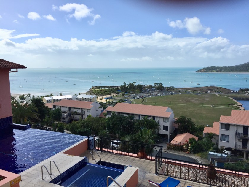
Bowen was also a big town with very flat agricultural land around. It was the closest we had come to the sea since leaving Townsville, and occasionally we caught glimpses of it.
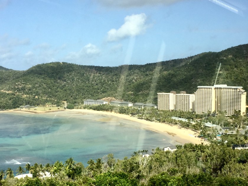
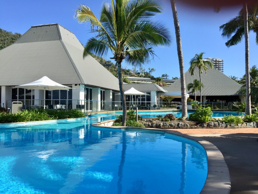
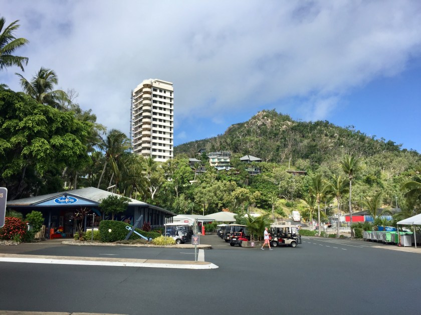
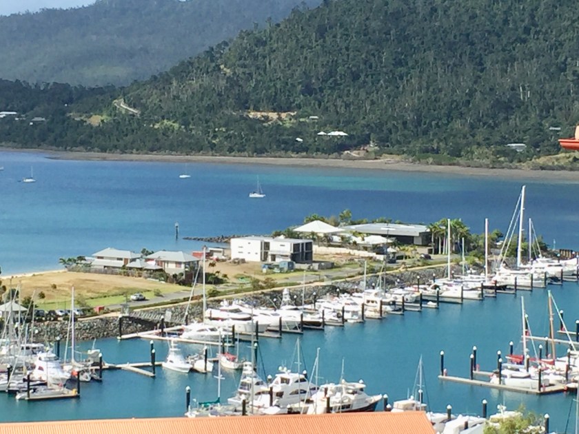
We turned off before Proserpine and came out along the road to Airlie Beach. We passed through Cannonvale, a suburb with a big shopping plaza that included Woolworths and Big W. Then another shopping centre, this time anchored by Coles. This was no small place. Airlie Beach itself has all that is good and all that is bad about it. The location is stunning, looking out to some of the closer Barrier Reef Islands, like Daydream, Long Island, and South Molle. It is quite hilly behind the town and developers have used up this space to completely cover the hillside with resorts (ours being one of them). Naturally the views are magnificent but from the shore it looks awful. They are even starting to move around the hills, establishing new areas. Down on the flat, there are areas that are green space at present, but with signs talking about future developments – a shame, as the green space separates town from the hill development. The actual shopping strip of Airlie Beach is delightful, a cute collection of eateries, clothing shops, souvenir places, a couple of upmarket back packer establishments – all along a strip of road that forks to make a “Y” shape. In front of the shopping strip is parkland along the waterfront that has recently been landscaped. The Council has put in a large freeform interconnecting system of swimming/leisure pools. Some with lanes, some with beach, some deep, some shallow for children. Lovely – and it is not fenced, and therefore free for anyone to enjoy. As the stingers are a problem for half the year, this is almost a necessity. A marina has been built at the southern end of the town and the sand used to create a spit with a beach beside it. Homes are being built along this small piece of beach – huge homes. On a couple of vacant blocks, people have erected signs that say “Stop inappropriate development”.
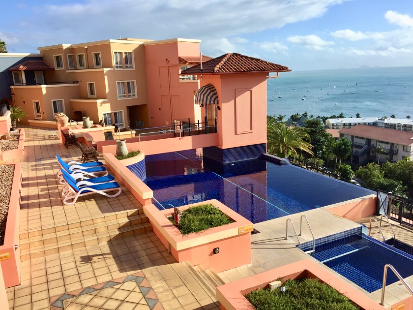


Pool area down by the water
Saturday had the weekly markets down by the beach and so what better thing to do than check them out. An interesting collection of things – handicrafts, fresh food, even a man making a very large sand sculpture.
The weather has been a real mixed bag – quite windy and cloud coming and going; It has rained each night but luckily not in the days.
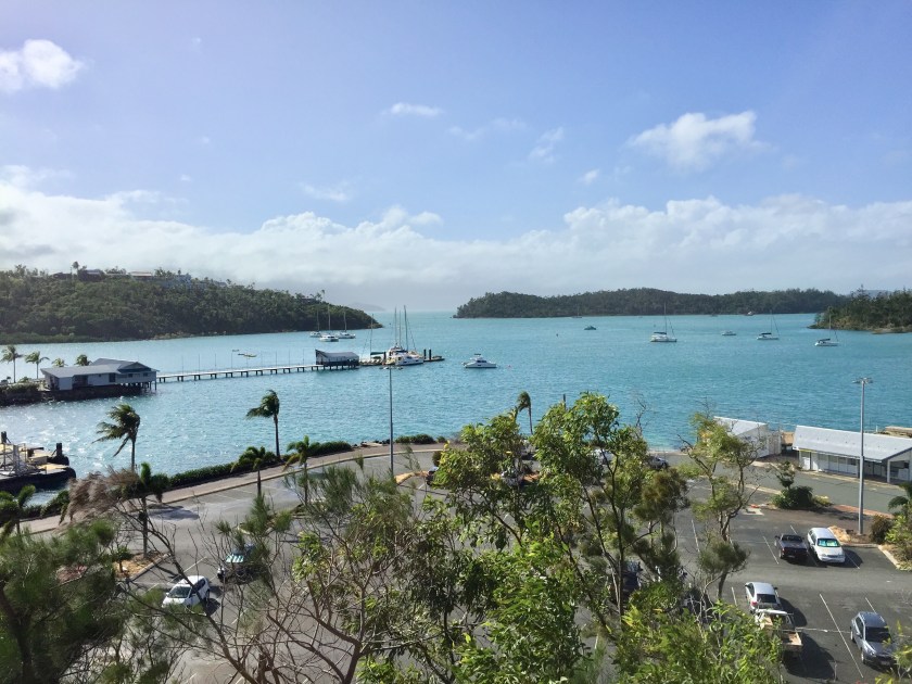
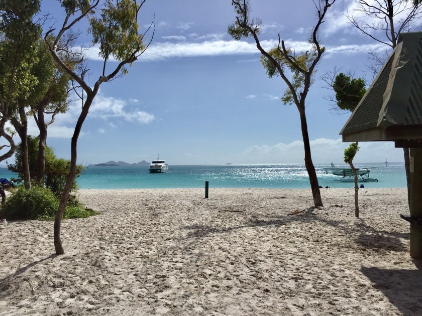
We went for a drive to Shute Harbour, about 10km south. It was Sunday and deserted. It is pretty much just a port (small) and there are homes up on the ridge surrounding it – with magnificent views north or south.We have since found out that this is the port used by the boats to take workers to Hamilton Island in particular but also to other islands. In Cyclone Debbie (March 2017), the wharf was destroyed, work still seemed to be being done.
We stopped at the bakery in Airlie for bread and they were very chatty. They said that Cyclone Debbie crossed the coast at Airlie and caused massive destruction. They were without power and water for 3 weeks. You couldn’t get in or out due to the road being blocked by so much debris. She said everyone helped each other. There being no power, no one could access teller machines or pay with cards, cash was king. She said they loaned so many people money. The great thing was there was no looting. This explained why the pool and park area looked so new – it had been done since the cyclone, when boats were lying up where the pool now is.
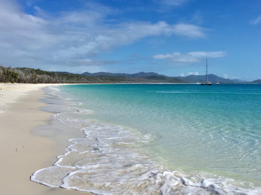
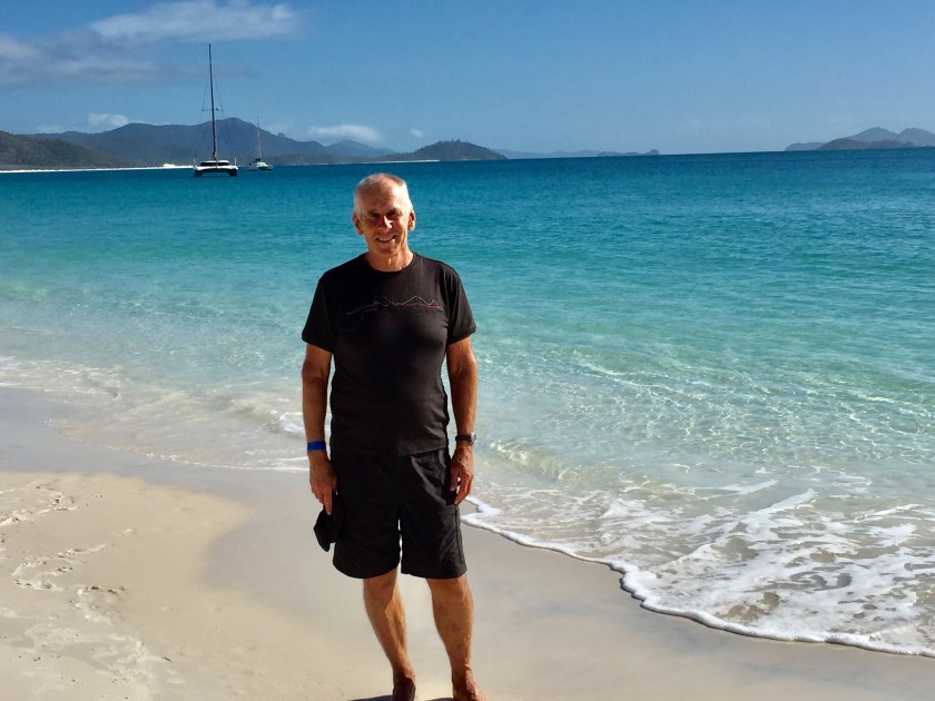
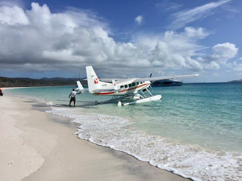
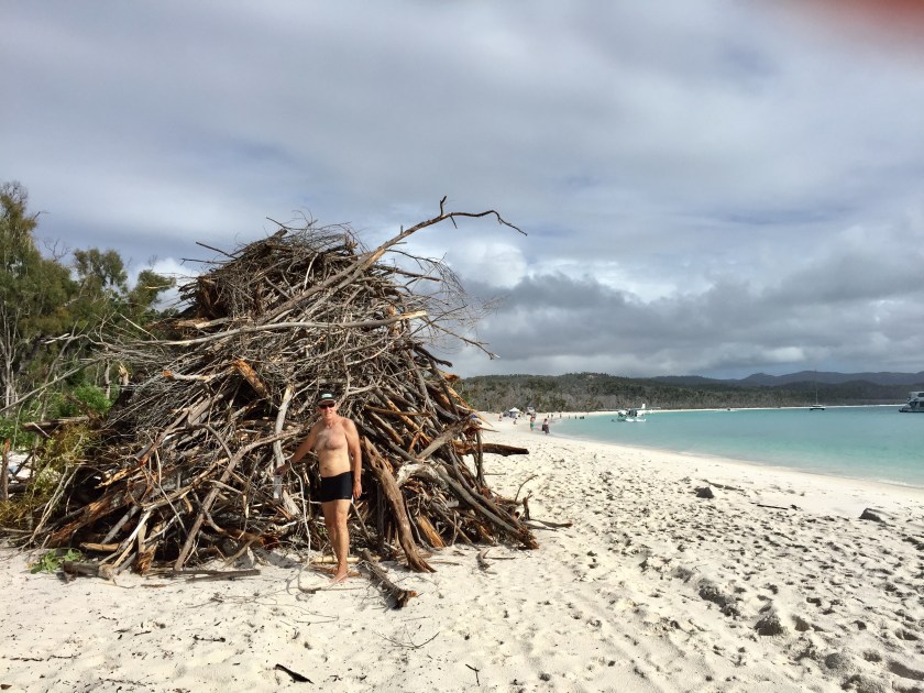
Monday we had chosen as our day to take a trip. The weather had been changeable and the SW wind had been blowing. Hopefully the weather would improve. We had to be at the ferry wharf in Airlie by 6-30am, so an early start in the dark. It was drizzling and cool. What a slick operation Whitsunday Cruises are, very like airport checkin, but no scanners. We boarded and left right on 7 – our itinerary being to go to Whitehaven Beach and then Hamilton Island. There were not a lot of people, maybe 40. The captain told us that it was not going to be smooth sailing, especially when crossing parts of open sea. We had both taken seasick pills. It was miserable weather – it was raining, the swell was causing spray to come over the windows, and this was a big boat. We first stopped after an hour at Hamilton Island to let people off and pick up a few more. Then another hour to Whitehaven Beach. This world renowned beach is on Whitehaven Island, the largest in the Whitsundays. We travelled right around the island, I think the captain a little embarrassed that he was going to put we poor folks onto the beach for 2 ½ hours, in the rain. We motored around Hill inlet and the sand came into view and I saw a glimpse of blue sky. By the time we had reached the southern and protected section, it was lovely blue sky. What a wonderful time we had here. The staff came ashore and set up a shelter and had beach games organised if anyone wanted to participate. Mostly we all were happy to swim, take photographs and wander the beach. The water was crystal clear and warm, the sand white and very fine, almost like powder. They said it was great to use to polish jewellery, so I gave my rings and earrings the ‘Whitehaven’ clean – now they sparkle! The crew had fun building sandcastles and mucking around. They said that the air was 25 and the water 25 but they considered it cool! We were so lucky with the weather and that there were so few people sharing this special place. A seaplane came in with a couple and their esky (picnic lunch) and they had to sit at the very end of the beach for the privacy that such a trip promises. There were lots of fish, in knee deep water, some quite large. National Parks was working on the beach as storms had caused a lot of debris to be scattered along the beach. They were gathering it up into huge piles. There will be some great bonfires soon.
This beach is meant to have the whitest sand in the world, hence it’s popularity. We didn’t think it the whitest we have seen, I guess I am a beach expert – ha ha. It was however, beautiful sand and a beautiful beach.
Our boat had been anchored off the beach, and after more than 2 ½ hrs we went out on a tender to it and travelled back to Hamilton Island – ¾ hr. Here we left the boat and had nearly 5 hours to explore. This was a very cheap way of seeing what Hamilton Island is. It has an international airport and I think this makes it popular with tourists wanting an ‘island’ experience and the chance to be close to the Barrier Reef. Lunch had been supplied by way of a voucher at the Marina Tavern, so we set off to find that. All the retail seems to be around the marina which is home to some massive boats. There were the usual resort boutiques, chemist, bakery, tour operator and a cafe. The tavern was at the end on the way to the Yacht Club, a big, impressive structure, we think meant to resemble a whale. There were not many people here and it was lunchtime. We asked the waiter about this and he said it was very quiet on the island, numbers were down. The conference centre has not been rebuilt yet after the cyclone and he thought that might affect things. Still a lot of time to explore. They have 2 little shuttle buses. The green runs along the front of the marina and the blue, goes right around the island. We set off to find the blue bus. We had to walk a very steep hill and then down to the other side of the ridge to be in the vicinity of its stops. This was also where the main resort building is. A huge rather Polynesian structure, it has 3 pools, terraces, bars and eating areas. Oh, the hotel type shops, AND a bowling alley? The various accommodations are around it, including the very inappropriate high rise buildings. We found the bus and jumped on. It was a 40 minute loop with a chatty driver. A great way to see everything. We were surprised how hilly the island was and how much private development was also on the island. One Tree Hill, a high point, had magnificent views. Back to where we started and a wander down to Catseye Beach, the main beach in front of the resort. The tide was out so it was a long walk out to water if you wanted a swim. We chose coffee. A walk back to the marina and a bit more exploring. The thing really puzzling us was where do the people buy food to cook themselves, particularly the people living there. The general store was all locked up and appeared to have permanently closed. There was an IGA sign on a warehouse in the marina but in a part out of bounds. Can only think you order and it’s delivered? The other thing you cannot miss are all the golf buggies. They’re everywhere! The island is very hilly and it would be hard to walk everywhere, especially with children or if you were older. So, everyone seems to get a buggy. I googled the cost to hire and they rent by the hour, but 24hrs was $87. Not cheap. Our boat was leaving at 5.10pm but at 4.30 all these people came from everywhere in fluoro shirts and assembled at the wharf. They were the workers going back to the mainland. There was quite a bit of construction going on, hence all the workers. Their boat was going back to Shute Harbour and left before 5. Ours turned up, people got off who were staying at Hamilton Island and we got on. The boat had been to the outer reef for the day. It was a smoother trip home, getting to Airlie just after 6 and in the dark. It had been a long but great day. Our time at Whitehaven had been delightful and the visit to Hamilton Island very informative and interesting. Not really interested in going there again.
We had had to get up at 5.30am to get the early boat and I had heard a lot of traffic noise down in the town. It now made sense, that was the tradie peak hour, driving to Shute Harbour for their boat to Hamilton Island.
We were too tired to pack for our departure in the morning, bed looked good.