THE BEGINNING OF THE TRIP HOME

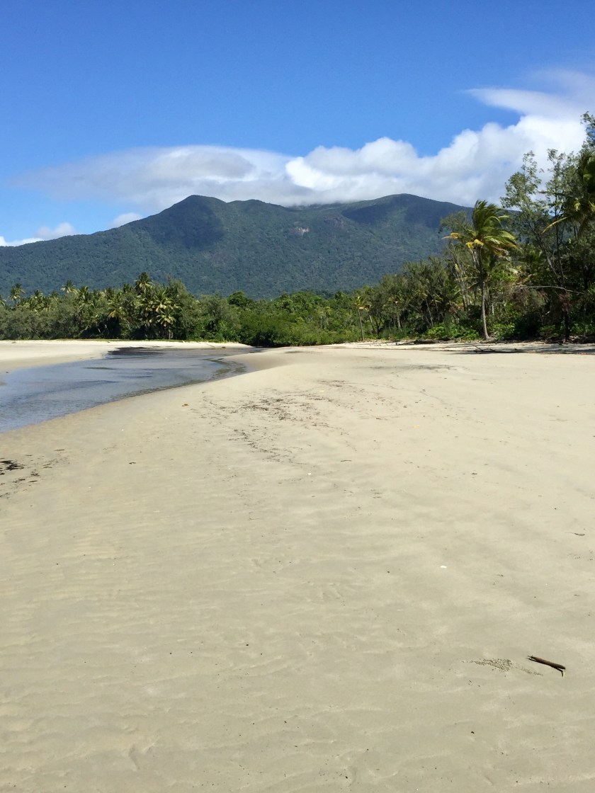
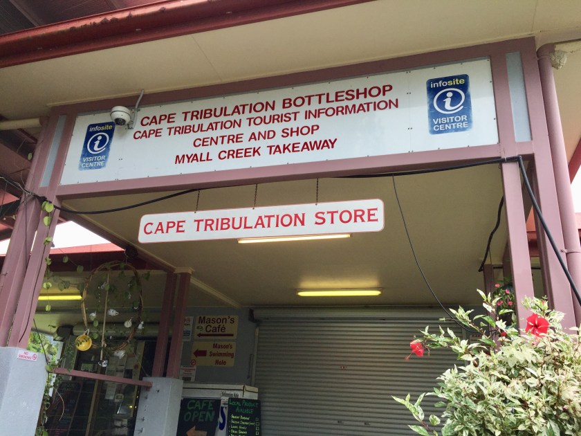
Even though we actually turned the car south at Cape Tribulation, it hasn’t been till now that we have really thought about how we will get home from Winton. Winton had been a destination we were hoping to get to and almost didn’t given how hard it can be getting accommodation in these outback towns. Once we had organised the Winton accommodation we also booked a night at Longreach, but after that – we still had to plan. We have decided on a plan and off we set for Longreach.
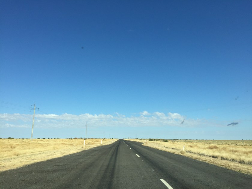
Longreach is only 179km from Winton. The road was so flat, and until the last 30km almost treeless. We saw tumbleweeds blowing across the road and up against the fences. What was even more remarkable was all the caravans – either coming towards us from Longreach, or the number Paul had to pass. We might have seen 2 cars not pulling a van, but no more. No wonder even the caravan parks are full – for powered and non powered sites.

IMG_3835
Road between Winton and Longreach

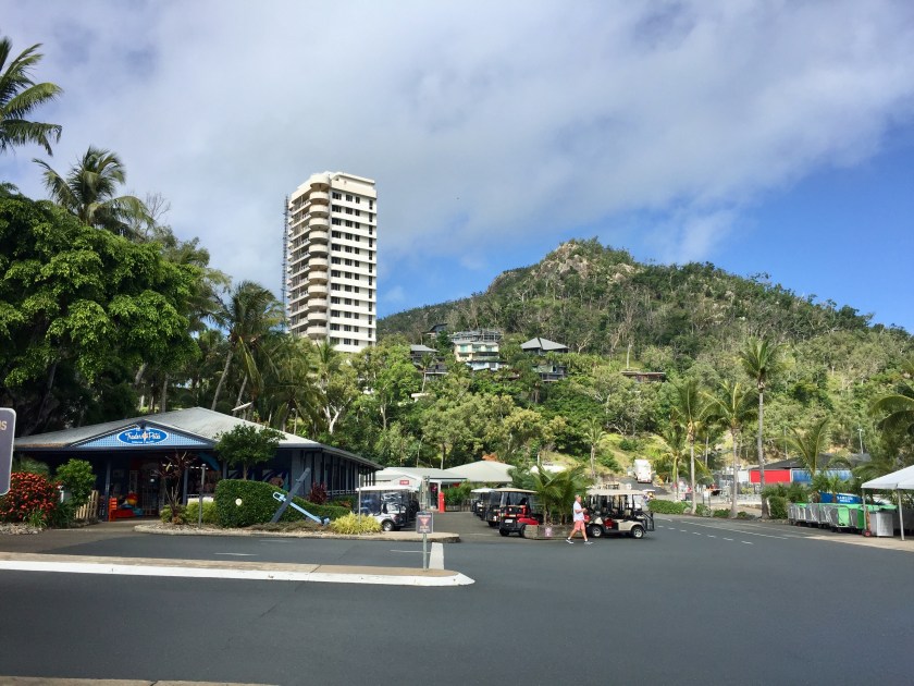
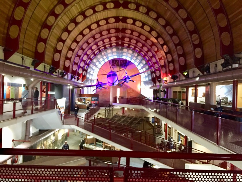
We were in Longreach before midday and found our way to the Stockman’s Hall of Fame – a very modern building opened in 1988. We took ourselves through the various areas it had, some very interesting, some the sort of thing we have seen elsewhere. Paul also went through the QANTAS Founders Out back Museum which was just opposite. All the streets in Longreach have bird names.

IMG_3845
Stockman’s Hall of Fame

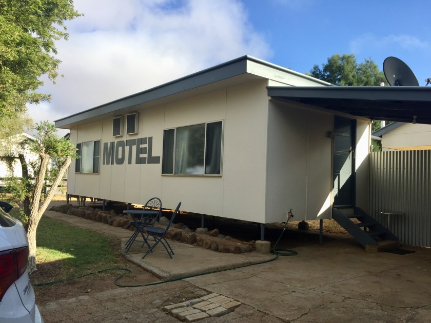
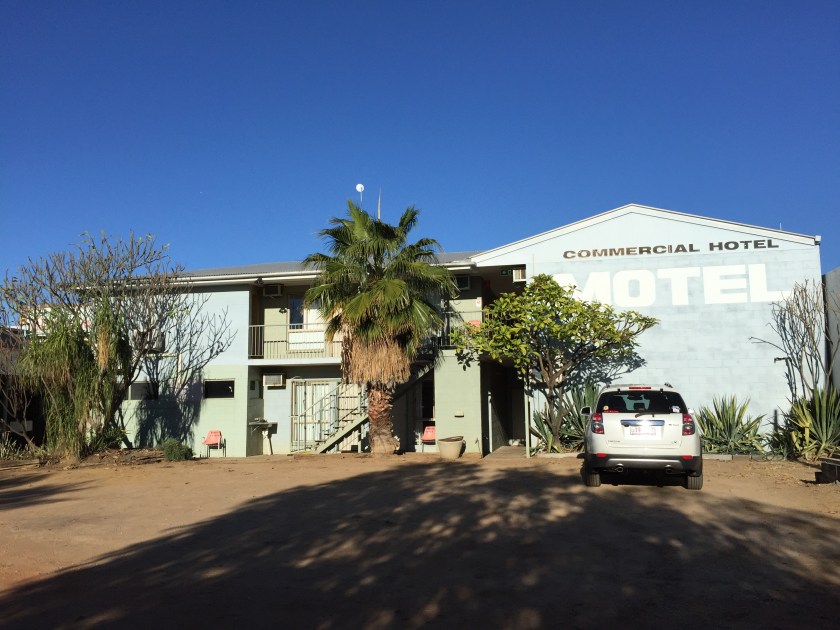
Back to check in to our motel room at the Central Hotel. Certainly not something you would choose if you saw it from outside. A few rooms attached to the pub with a dirt parking lot outside the door. We both looked at each other and asked why did we choose this one? The answer we think was that was all there was available. However, inside was pretty good apart from understanding that the floor could never be clean with the dirt outside. Luckily we’re travelling with some white towelling slippers we got on Orpheus and that solved the problem.

IMG_3850
Our motel room at Longreach – ground floor behind the stairs

We went for a walk down the main street to see where we could eat dinner – not many choices. The pub we were at didn’t appear to have a bistro, but the one opposite did and so that’s where we went. It was very satisfactory and just a walk back over the road to our room. We were a little worried that we would get cold in the night as the air conditioning was not reverse cycle, so we had no heating. We should not have worried, despite the outside temperature being 5 degrees when we went out in the morning, we got hot and kicked the dooma off in the night. The room remaining very snuggy. Not sure how it would be in summer when the temperature rises into the 40s.
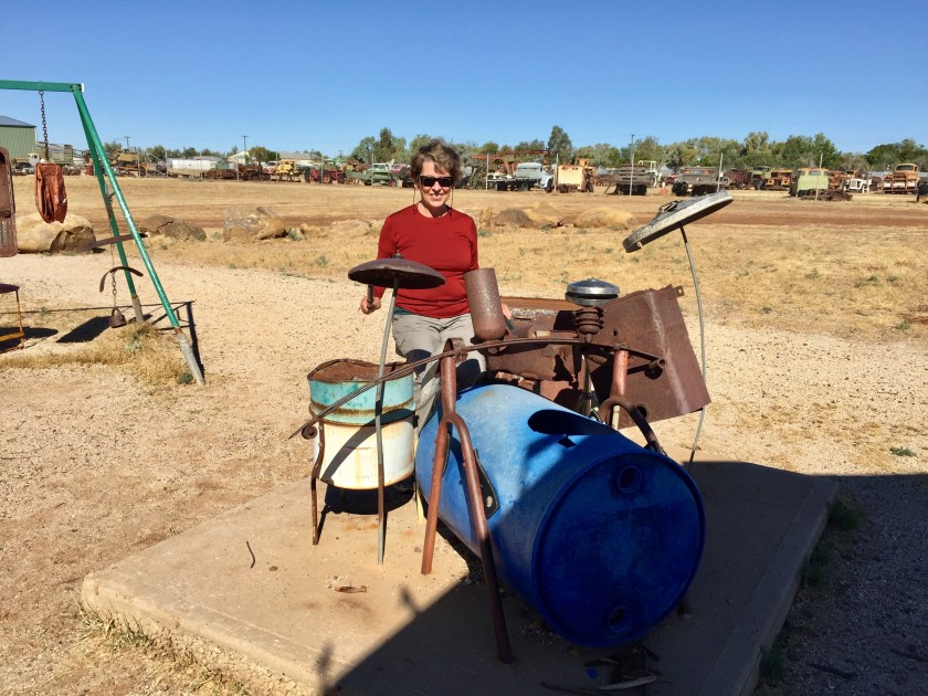
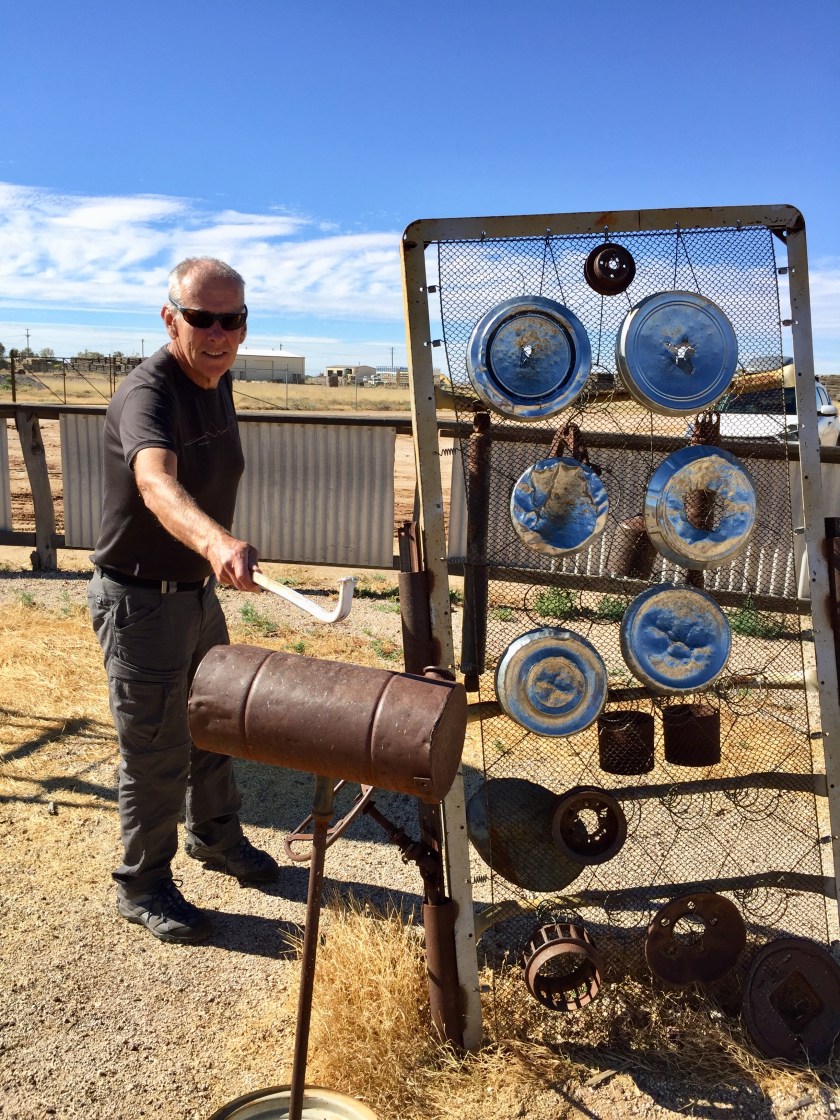
A new day and we set off for Charlevillle – 517 km away. We didn’t get far when cars and police stopped traffic to allow a semi with a huge piece of machinery to pass. 28km out is the town of Ilfracombe. A small town now of just over 200 people, but it used to be very big. In 1893 they sank a bore 1km down and access to water allowed the land to carry more sheep than ever before and Wellshot Station became the largest sheep station in Australia. Now the little town is perhaps famous for the 1 km line of incredibly well maintained old farm machinery and vehicles that line the main street.
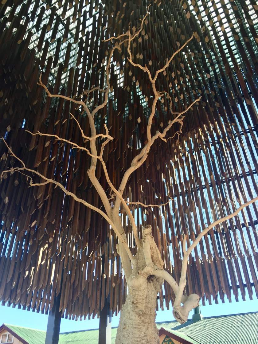
Then 80 km on was Barcaldine, pronounced Bar call din (Scottish). The town is home to the Tree of Knowledge, reputed to be the ome of the labour movement in Australia. Someone poisoned the tree in 2006 and it died. They have preserved the tree and covered it with an ugly wooden structure. There is a lovely old railway station behind it.

IMG_3865
The Tree of Knowledge – now covered by a wooden structure

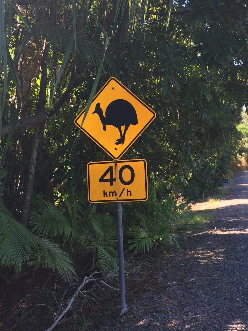
Another 100 km to Blackall. The landscape remains flat, the road straight, the vegetation varies from stunted trees/bushes to small trees. There is very little evidence of livestock, probably because the land is in drought. We did pass some cattle being grazed beside the road. You have to drive slowly as they are stupid and wander back and forth on the road. I had wondered why, if there is so juch drought, we have seen no signs in places asking that we conserve water. The answer is that they are all using water from the Great Artesian Basin. In Winton the sulphur smell was very strong, but by letting the water sit, it became good drinking water.
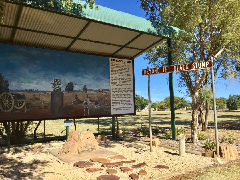
Blackall was another small town. We stopped for coffee and a huge piece of carrot cake that had thick icing, cream and yoghurt accompanying it. A nice place. We checked out The Black Stump behind the local school. This was a tree stump used by the surveyors to place their transit to gain latitude and longitude observations. The use of a stump gave more stability and accuracy. As time passed, any country to the west of Blackall was considered to be ‘beyond the Black Stump’.

IMG_3870
The stump at Blackall, known as The Black Stump

Just out of Blackall we passed the Barcoo River, made famous in poems by Banjo Patterson in the Man from Ironbark.
Then on to Tambo, another 100 km. Halfway along the highway there were some small undulations but enough to see the vast yellow plains and some distant ranges. It is a constantly changing landscape.
It was then approx 85km to Charlevillle, supposedly the biggest town in SW Queensland. The scenery changed again, the trees were higher and we couldn’t see through them. Charlevillle is a bigger town but still not that big. We have a very nice motel, more your standard good motel room, and gravel, not dirt.
We ate at the restaurant at the motel, an unusual thing for us, but we had checked out the town and the choices were the pub and RSL. Both were uninspiring and expensive and we were booked on a tour at the observatory at 7.30. Our motel was a few hundred meters away and their menu looked better. We had a lovely dinner – Paul having kangaroo cooked as he asked – rare, and I had a good rack of lamb. We then headed off to the Cosmos Observatory. We had paid more to be on the 1 ½ hour tour with only 4 others, rather than a big generalised tour of 1 hour. So well worth it. Mike took the 6 of us to a separate area with an opened roof and a big telescope. It was very cold. Luckily we had layered our tops, had coats and beanies. I also wrapped a blanket he offered around my legs. He then proceeded to point out and explain 12 stars, planets, dark mass areas ….. He was the boss here, an astro physicist who just loved astronomy and physics. He explained so much and showed us so much. Of course the piece de resistance was seeing Saturn and her rings, just how it looks in a book. Wow. We were lucky it was a crescent moon and Charlevillle is small, so not much light affecting the sky. A great night.
On to the next stage of the drive home – to Bourke, 5 ¼ hours away. There is really only 1 town in between – Cunnamulla, 196 km away. The soil became very red once we left Charlevillle. We had a scary moment when we overtook a wide load (looked like a toilet block on the truck) and just as Paul was accelerating past, a kangaroo jumped in front of us. We did go through a one house town – Wyandra, 28km out, not much there at all, but once a much bigger place. We were shocked at the condition of the land – it is in such severe drought. Any tussocks of grass are dry and dead, otherwise the land is red soil, almost as if it is ploughed awaiting planting, but of course it isn’t. The other thing is the amount of roadkill. There was so much Paul was zig zagging around it a lot of the time. Worst problem was if you were meeting an oncoming car and there was a dead animal and you wanted to go around it and the oncoming car prevented this. We did go over one, yuk! After 1 ½ hours the caravans started coming through. So many heading north. Ironically along this road there were many signs warning that this was a floodway!

IMG_3880
Gates to a property between Charleville and Cunnamulla. Such severe drought.

We stopped in Cunnamulla for coffee. Not a big town but they had taken a lot of time and care making it as attractive as possible and when you think of the drought around the town, that is something.
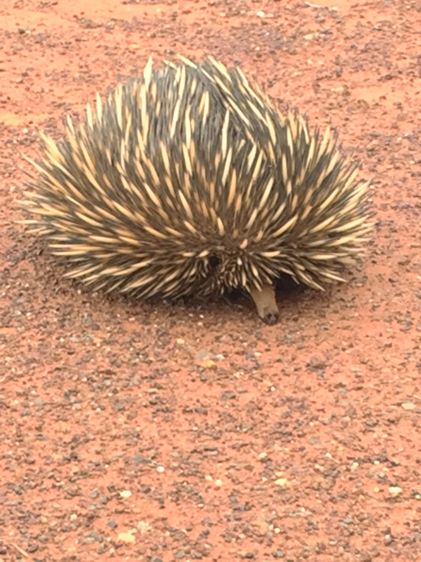
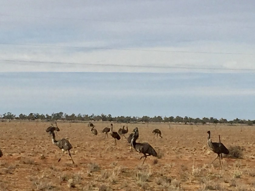
Cunnamulla to Burke was 250 km. After 122 km we came to the NSW border and the town of Barringun. We had intended to stop here and have our lunch in a park. No. It was a dusty, old, collection of 1 or 2 buildings, nothing else. Hard to tell if they were derelict or inhabited. We kept going another 38 km to Enngonia. Slightly better. There was a pub, not a cutesy old fashioned one, just a besser block box. Opposite was a park with some childrens old play equipment, a couple of picnic tables covered in bird poo and a toilet, that was opened 1 year ago and the locals were proud of. We made a quick lunch, chatted to a guy with 2 dogs who had also stopped and we had been following for a long time. Back on the road and still so much road kill. I have now realised that what you see beside the road that is white, is actually the white bones of previous roadkill, pecked clean by the birds and other predators. So much fresh road kill, so much old road kill. We decided to start counting it (need something to do) and after a minute we were up to 20+! On this stretch we also saw more animals alive. There were lots of kangaroos, another jumped across the road in front of us, but also goats, emus, a couple of camels and a dear echidna. He was sitting on the road and started moving as we approached. Paul stopped the car and we walked over to where he was sitting, raising all his spikes. He had a really cute nose and face. Hopefully he wasn’t going to go back onto the road again or he too would end up like all the others.

IMG_3903
Our echidna – not so happy to see us!
IMG_3887
Lots of emus

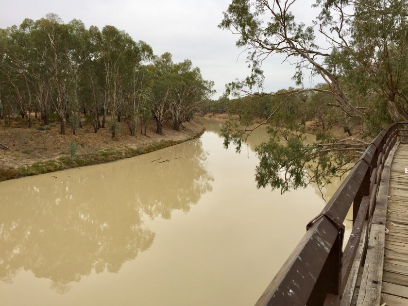
We reached Bourke – surprised that there is a North Bourke, 5 kms before, on the other side of the Darling River. We drove in and found our accommodation, the Riverside Motel. It is a collection of old buildings along the Darling River, cleverly converted to accommodation. We are opposite in the Priest’s House. They have divided it up into 8 separate units – ours is big, tastefully furnished and has heating, which they had put on before we arrived. It is a big house, so not sure how many used to live here. It is on the ‘mighty’ Darling River. We wandered over to look. It is a sad sight. Yes it is running, which is much more than the rivers we have crossed in the last couple of days, but a sign warns against swimming as it has an algae problem, it is so muddy and by the look of dead trees in it, not very deep.

IMG_3907
‘Mighty’ Darling River

We drove into the main street, some lovely old buildings, but for the size of the town, not very big. We looked for somewhere to have dinner and there were a couple of places close by, nothing special but all charge $30-35 for a main course. It is interesting that where we are staying they lock the gate and the cars in. So many places seem to have big fences around them? Dinner was at a place called Diggers – a collection of small rooms where you could have meetings or eat. Very bistro like. It was only during our meal we realised it was an RSL. Anyway we actually had a very good meal and then walked 100 m back to our warm room.
Thursday – sunny day but 5 degrees when we packed the car. First stop was Nyngan, 2 hours away. The land was still so drought affected. The road was still soooo straight. 40 mins after Bourke we came to Mulga Creek with the Mulga Creek Pub – a real outback style pub. Not much else there however. Just after this we passed into Bogan Shire on the way to Coolabah. This small town had an old general store and a few old buildings. It was at the crossroads for the road out to Brewarrina.
The road continued straight but there were now some tall trees beside the road. 15 mins before Nyngan we were stopped for road work. This was the first time not only was their a red/green light, but an actual boom gate, and then when we did get the go ahead, we had an escort vehicle to take us down the road. The stop/go man, not sure why he was needed, was sitting beside the lights with his feet up on it smoking. We also started to see some cattle and some water in dirt gullies. So much of the land is now ploughed and awaiting a crop – we think the winter crop they can’t sow because of lack of rain.
After Nyngan it was Trangie, then Narromine before arriving in Dubbo. This was the first time we had seen streets of houses with kerbing and guttering since Townsville, a week ago.
Dubbo to Orange was another 2 hour drive and the landscape changed again. We are now getting to the rolling plains, curves in the road, more traffic….  We had intended staying in Orange, then it became Bathurst, an hour away.  However, it was only just after 3pm and we both felt up to it, so we decided to drive the last 3 hours home. A stop at Katoomba, looking for a coffee shop for a coffee for Paul and hot chocolate for me, was not fruitful at 4.15, so it was Blaxland McDonalds for some coffee for Paul.  We reached home at 7pm and decided to pretend it was a motel, only bringing in the absolute minimum, and getting a pizza for dinner.  Our own bed!  Best bed out there and we have stayed in some very nice places, as well as the other types.  Worked out there had been 18 different places we had stayed and we covered just over 7500 km.  A fabulous trip, but great to be home.


INTO THE LAND OF THE DINOSAURS


It was only a short day today. 45 kms to Hughenden. The scenery changed to grassland – Flinders grassland and short bushes. There were a few cattle but then we saw the solar farms. Huge tracts of land with solar panels, some still being built. We passed Mt Walker, a mesa, something breaking up the flatness. They hold a 4km run up Mt Walker every year. Hughenden was much smaller than we expected. There were very few people around and hard to believe we couldn’t get accommodation here the night before. We stopped at the Flinders Discovery Centre, perhaps the only new building in town. Here we saw the huge Muttabuttasaurus outside and inside a wonderful collection of fossils.

IMG_3684
Muttabuttasaurus in Hughenden
IMG_3699
Fossils

It was 212 km from Hughenden to Winton on the Kennedy Development Road. Because we had turned off the main highway, there was no traffic at all. We passed only a couple of cars the whole time. This land was very very flat. There was grassland and some stunted shrubs, but not much else. Soon this just became the grass, the guide book calls it Mitchell grass here, but it all looks the same to us. 80 km before Winton was Corfield, a town with a population of 10. There was an old pub and a couple of houses. In August the population really swells as everyone comes to the Corfield Cup. As we had been driving, we noticed double fencing and what is obviously a stock route. Reasonably frequently there were water soaks or sometimes small dams, mostly dry at present, for the travelling cattle.

IMG_3704
Road from Hughenden to Winton

We arrived at Winton at lunchtime and there were quite a lot of people around. We checked into our accommodation – outback satisfactory and then went back to the new Waltzing Matilda Centre. This was only opened a couple of months ago after the earlier one was destroyed by fire. It is very state of the art, with headsets and lots of electronics. It is all about Waltzing Matilda relying on the fact that Banjo Patterson wrote it here. Apart from the presentation inside on this, outside were displays of early Australiana – things we have seen a lot of elsewhere. There was an excellent art exhibition in their gallery – perhaps 24 paintings by very well known Australians.

IMG_3725
Paul with Banjo Patterson outside the Waltzing Matilda building in Winton

Saturday our plans were to go to the Australian Age of Dinosaurs Museum. We did but before that, we caught up with Wayne, whom we met at Injune almost 5 weeks ago. He has been riding a pushbike from the Gold Coast to the Red Centre and has reached Winton. We had just noticed a post on his Facebook saying he was in Winton for a few of days. So were we. In a roundabout way we made contact, met him at his hotel and agreed to meet up for dinner. Then off the 24kms to the museum. This was a fantastic 3 hour tour. It is very modern, only 1 year old, situated on top of a mesa. Firstly they took us to the labs to see volunteers working away cleaning the dinosaur fossils, explaining how they got them and how they preserved them. Then there was a presentation with real bones and a video showing how the bones related to the dinosaurs – Banjo (carnivore), Matilda and Wade (both herbivores). Matilda they believe was 16m long! The use of technology enabled them to make the dinosaurs come to life. Next we got in a small electric train and were taken to the edge and down the side of the mesa. Here they had created bronze replicas of dinosaurs. This was a very professional place and we enjoyed it.

IMG_3727
Age of Dinosaurs
IMG_3751
Actual dinosaur bones of Banjo that they have encased. Bottom right is the foot of an emu to give some indication of size.

We met up with Wayne at 5.30 at his hotel, the North Gregory Hotel. A hotel now in its 4th incarnation, twice having been burnt down. In the courtyard, a fellow called Gregory North, was telling the story of Banjo Paterson and reciting some poetry. We then went inside for a very enjoyable dinner. As we were leaving we got chatting to a mother and daughter, having dinner. They were locals and we enjoyed hearing about the area and the town from them.

IMG_3709
All the garbage bins in Winton look like this!

Sunday we had arranged with Wayne to pick him up and head out to Lark Quarry to see the Dinosaur Stampede footprints. This was a 110km trip out from town. The brochures and locals said it would take 2 hours as the road was mostly dirt. We set off, not passing another car, watched a kangaroo jump across the road in front of us and took about 1 hour 20 as mostly the road was sealed, often single lane, and any dirt was ‘good’ dirt. We decided to boil the billy and have the lamingtons that Wayne had brought along while we waited for the tour. So appropriate in this very Aussie outback setting which we saw yesterday, has been the site of quite a few movies and you can see why. There were eroded mesas, spinifex, stark colours and  the building housing the footprints. We joined the tour and were shown the genuine 3300 footprints that they have excavated, of dinosaurs fleeing. There were 3 types of dinosaurs – the small coelurosaurus – chicken size, they estimate 86 of them. Then small ornithopods, the size of an emu, they estimate 70 of them, and then one large theropod (Tyrannosaurus), as big as a Clydesdale horse (although his footprint was huge). He supposedly came upon the others and saw dinner. There ensued this stampede. The footprints are there in the mud stone. Our guide explained how they could tell that the dinosaurs were running rather than walking by the fact that the toes had the deep imprint. If they had been walking around the heel would have taken the weight. Fascinating. They have constructed a temperature controlled building over this site, to protect the footprints and rock from the severe temperature extremes. We had our sandwiches here looking out over a wonderful outback landscape. On our trip back to town we had 3 emus run across in front of us.

IMG_3813
Dinosaur Stampede, 110 km from Winton. Such a magnificent, raw, landscape.
IMG_3806
Dinosaur footprints, small ones running away from the big footprint of the Theropod
IMG_3774
Recreation at the Dinosaur Stampede of the stampede

Back in Winton we checked out the Musical Fence. This has been made by using different wires in the fence and putting on top 2 rustic frets. There was a bucket with pieces of iron, rubber, pipe you could use to make your music. Then there were the other instruments – a drum kit made with various metal containers (drums), saucepan lids (cymbals) and other bits and pieces. A rotary clothes line had metallic instruments dangling from it. A fun place for the 3 of us to pretend we were kids. Noone else was around.

IMG_3824
Having fun at the musical fence


IMG_3828
More musical fun

Next stop was Arno’s Wall. Arno built the 90m wall down the side of his house embedding all sorts of junk in it. There were all sorts of things – a bike, lawn mower ……

IMG_3832
Part of Arno’s wall

We agreed to meet up with Wayne later for dinner. So at 5.30 we returned to the North Gregory Hotel, first assembling in the dining room as Gregory North had the room all singing Waltzing Matilda as he played the pianola. Then we all went out to the courtyard and he did a variation of what he had done the night before. He does this every night. Tonight he told the story of Banjo Patterson but with more poetry, starting with his birth and A Bush Christening. He told us all about Banjo but it is interesting that his only connection with Winton is that he visited a property out from Winton where he had dinner and listened to one of the women playing a Scottish tune. He asked about words, she didn’t know if there were any and he suggested trying out the words he had written for Waltzing Matilda. So it came about. He left the area but Winton has clung to this piece of history to create something much bigger. It was back to the dining room for dinner and another very enjoyable night with Wayne. We said goodbye as we were both leaving the next day, we for Longreach and he on his pushbike for Boulia, then Mt Isa and eventually Alice Springs. An amazing feat, a great guy.

OUT AT THE PRAIRIE


The next part of our journey was directly west of Townsville. We had had difficulty getting accommodation in Winton and had to delay our trip for this reason, staying in Townsville. This had actually turned out to be a great thing. We had also had to find somewhere to stay before Winton, and as Hughenden was also booked out, Paul noticed a small dot on the map, 45 kms before Hughenden, called Prairie. There was only the hotel for accommodation so he rang and it appeared we could have 1 of the 2 motel rooms. We said yes, not knowing what we were going to get.
The trip took us back out through Charters Towers and we had coffee again at the cafe in the old Stock Exchange Building. Then another 2 ½ hours to Prairie. We had travelled a long way without seeing any sign of activity on the land – no cattle, sheep, crops, even emus or kangaroos. There had been a lot of very long trucks – mostly with 3 trailers but some with 4. Overtaking was a tricky thing as there was always something coming the other way. This is the direct route to Mt Isa.
We arrived at Prairie. A real dot on the map. There was a small school (total enrolment of 15), a couple of houses and the pub. It was one of those corrugated iron buildings with a hitching rail out the front (with old saddles on it), kegs for tables and some flowers. Cute in a messy outback style. We walked to the door and Tom looked up from his coffee. Yes, he did have a room, yes he’d get the key. I asked if they did dinner, yes they did. Not a lot of communication. Anyway we checked out our room and were grateful that it was quite good inside, despite outside appearances. Around 5 we wandered into the bar for a beer. There were already 3 at the bar (turned out to be mannequins). The bar had hats over the roof and walls and there were bits and pieces of everything everywhere. Tom was watching Millionaire Hot Seat, but managed to get us a beer. Shortly after John came in. He worked for Elders and was staying overnight in the other unit. We got chatting and were soon joined by another couple, Colin and Joy, who were staying in their caravan out the back of the hotel. We all asked if anyone knew much about dinner. Noone did. Joy said they were just told to be in the bar by 6. We were soon joined by Andrea, Tom’s wife. She was friendly but didn’t want to answer questions about living in the pub, their life outback etc etc. she said everyone asks these questions. She did tell us that they have 3 daughters, Lily 14 who has to go to boarding school in Charters Towers, but that she drives her there very early Mon mornings so she can have normal weekends with the family. Then there was Bella 11 and Cherry nearly 8, who go to the small school. She said she had lived out here since the 1990s. Anyway she excused herself to get dinner and we chatted on. Around 6.30 she announced dinner was served. We moved to the room next door, the dining room. One of the girls stood waving us in! There were several tables but one seating 12 was set for the 5 of us and our meals were sitting there. It was chicken schnitzel, chips and salad. The room looked good (not sure about in the daylight). There was a huge chandelier above the table and candles on the table. All around were bits and pieces from grandma’s house. The 5 of us had a very pleasant time – just like we were at a dinner party.
It was not a quiet night. There was the goods railway on the otherside of the road, parallel to it, with several trains running by through the night. Then there were the big trucks, still rattling through all night. They didn’t worry Paul too much, but I heard a lot of them, the worst being around 4am when one stopped right outside and left the engine running for at least ½ hour. All I could guess was that he had stopped here for a shower (they had showers and toilets outside for the other 2 rooms they had available). Anyway, eventually he took off. My other problem was when I went to the toilet in the night and found a green tree frog in the toilet! I didn’t even wake Paul, tried to take a photo and he disappeared into the water??
That was Prairie, a great experience of outback Australia. Glad we did it.

IMG_3646
Prairie Hotel with old saddles outside.

IMG_3676

Our motel room at the Prairie Hotel – one of 2 motel units

IMG_3658
Only 2 real customers at the bar.
IMG_3662
Our dinner party with new friends


FOURTH TIME FOR TOWNSVILLE

We left Cairns on another brilliant sunny day – no clouds and going to be 27 degrees. The first part of this trip to Townsville, 3 ¾ hours away was new, as when we came up we turned inland at Tully to go to the Atherton. Once more it is sugar cane everywhere. Everyone seems to have a plantation. We travelled through Gordonville, Babinda, Innisfail and down to Tully, where we thought we might have coffee. Well, no. The main street was very quiet and no coffee shops. Back past the IGA and a few surrounding shops. Yes, there was Evelyn’s cafe but, no thanks. So we left the town with the big golden gumboot with a green tree frog climbing it and headed on to Cardwell where we had coffee and sandwiches. Cardwell looked beautiful today, cloudless blue sky and the big Hinchinbrook Island just off the coast. So hard to believe that this little town was devastated by Cyclone Yasi in 2011. A picture in the cafe shows a satellite image of the eye of the cyclone, stating winds reached 420km an hour. Amazing that there are still some old houses and tall palms that obviously withstood it. The marina area we remembered is so sad, really needing some developer with buckets of money to turn it back into a great launching pad for Hinchinbrook and the other outer islands.
Then it was down through Ingham to Townsville.

We worked out it is the 4 th time through Townsville and 3rd time staying here. This time we were staying down near The Strand – the waterfront. An older style but comfortable villa and good we could drive to the door to unload. I had worked out this was our 13th different accommodation. We needed to shop for dinner and so went back to our old stamping ground of Castletown, 10 mins back where we had stayed before. Paul went to bbq for us and met a couple of women sitting having a pre dinner drink. One worked 6 months of the year for the Flying Doctor, in various places and the other was an author who donated the proceeds of her books to the Flying Doctor. She had written a book – Women of the Gulf – and lent it to Paul to bring back to our unit and look at. (We took it back the next night and bought a copy.) After dinner we went for a walk to the end of the street and around the foreshore – an area they called The Fortress. This was lit and had sculptures along the path. There was a lot more but it was late and we were tired. Another time we must see more.
On Wednesday we had decided to go to Magnetic Island. It is only 8 km off the coast and dominates the view from the foreshore. A very well organised system makes it easy to do. We drove to the terminal, parked and caught one of he jetcats out to the island. They run 18 services a day. It was a beautiful day, the water was like glass and the trip smooth arriving at Nellie Bay. On Magnetic Island they have a hop on/hop off bus that makes it easy to get around. We had been expecting it to be like Hamilton Island and very commercial, but were pleasantly surprised. There is a big Peppers Resort at Nellie Bay along with a marina, but elsewhere it is much more low key. We caught the bus from Nellie Bay, around to Arcadia and Alma Bay, up over the ridge and then down into Horseshoe Bay. We got off here, had a walk along the beachfront, past a few cafes and accommodation places. It was beautiful. On the water side there were some hire places for paddle boards, kayaks etc. There was a lifesaver on duty at a flagged area of the beach and a school group trying to lash 2 rafts together before trying to paddle them. Very funny to watch 2 totally different groups – one with most cooperating and the other with the teacher trying to encourage participation but most just standing watching. I had decided that I would have a swim and Paul was going for a run. He set off for Radical Bay and a 40 min run and I went into the water to swim laps of an area with buoys marking the patrolled section. I did more than 35 mins and was the only one in the water.
The water was 23 degrees and very enjoyable. After some lunch we caught the bus back to Arcadia and looked at Alma Bay. The tide was out but it was still one of the most beautiful beaches I have seen. Here the water was crystal clear and so inviting. We then caught the bus back to Nellie Bay, chatting to another couple who were doing the same thing. It was a very pleasant trip back on the jetcat to Townsville and the car.

IMG_3604
Horseshoe Beach


IMG_3598

IMG_3610
Street and park along the front of Horseshoe Bay
IMG_3614
Alma Bay

We had to shop for the next 3 days and had found a much closer supermarket which was good.
We packed up on Thursday but as it was a shorter drive today, spent time driving up The Castle. This is a very prominent rock a few blocks behind the waterfront. It was 2.9km up a very steep winding road. We passed so many people walking up, some pushing strollers! The views of Townsville from the top were spectacular. We then went down to The Strand for another wander. Such a lovely spot.

IMG_3623
The castle from down near the beach
IMG_3624
View out over Townsville towards Magnetic Island
IMG_3636
Decorated container art in the park along The Strand. An exhibition from the Commonwealth Games.
IMG_3639
One of the beach areas along The Strand


INTO THE RAINFOREST

We tried to leave Palm Cove early, but the logistics of getting all our things down to the carpark on the luggage trolley (getting it from reception, negotiating it through pool gates back to our building and up in the lift) took time. But that was ok. It was a 1 hour drive up the Cook Highway, past Port Douglas to Mossman. We stopped half way between Palm Cove and Port Douglas so I could make my own “village” on a stony beach.  There were not many stones left, the village was so vast. Childish fun!

The drive north of Port Douglas was through lots of sugar cane country. They have started harvesting it and we passed a couple of sugar trains, hauling the sugar.

We stopped at Mossman Gorge, a few kms out of town. The running of the tourism is managed by the aboriginal owners and they have done a great job. A rather new building houses the information, cafe, souvenirs, administration and it is very modernistic in design. They ask that you purchase a shuttle bus ticket for the remaining 4 kms to the gorge, otherwise you walk the narrow road. Almost everyone did this. The shuttle runs every 15 mins and one was waiting for us. There are a couple of walks through the rainforest and down to the river. We did the 2.5km rainforest walk which wound around the rainforest and crossed the river on a suspension bridge. It took quite awhile as the track was very up and down with steps and tree roots. Some of the buttress trees were magnificent. We did a shorter circular route along the river. The sound of the water is loud as it washes down over big boulders. I think the boulders are what makes it very special. We caught the shuttle back and had coffee back at the cafe, looking out at the rainforest.

OLYMPUS DIGITAL CAMERA
Mossman Gorge
p1012514.jpg
Mossman Gorge
OLYMPUS DIGITAL CAMERA
Big strangler fig in Mossman Gorge


It was then back into Mossman for a last couple of things – they have a new Woolworths, probably needed as the town was surprisingly big. However we found it very hot, particularly after having been up the gorge. The locals obviously didn’t as we passed a fellow in a fleecy jacket and another in a warm coat and tracksuit pants! We have had to bring all our food for the next 3 days as there are no real shops over the Daintree River. We had done a big shop the day before in Smithfield when we had the tyre fitted.

After Mossman the road passes through a couple of very small towns and lots more sugar, before reaching Daintree. We had to queue for the ferry which brings you across the Daintree River. There is even a ticket booth you drive past before driving down to the ferry – $27 return. We had to wait with a long queue of cars but made it onto the next ferry – it seemed to take at least 20 cars. We then were in a procession as we all drove off. We stopped at Jindalba, a place I saw on the map had picnic tables and we thought we could eat our sandwiches here. It turned out to be set in another rainforest, with some walks from it. They were doing building work but we went to the shelter shed to eat and a worker sat down to eat his lunch and started chatting. Seems he was the supervisor but heavily involved with the aboriginal community and development up here. Anthony gave us a history of what has happened here, then showed us the black coconut tree and how the men use the base for their spears because it is so hard (he got an hammer from his ute to hit the trunk and let us hear the sound). He said the men gave the white top part to the women to make their dilly bags. He was very interesting. A couple of backpackers came and joined us to eat their lunch and realised they too could have a lesson. When we left he was still chatting with them. No need for a guided tour.

Our accommodation was only a few more kms away. It is quite unique – a pole house, down a long drive, with lush vegetation all around it. It is mostly solar powered with a bit of generator back up. The sides all open up for ventilation, luckily there are fly screens. Everything is timber inside.  A huge kitchen after the last 5 days. A very wide verandah runs the length of it with tables and chairs there as well.  You look out over lush palms, trees and “green” – like being  high above the forest. Very comfortable.

IMG_3481
Tea Tree Cottage
IMG_3482
Bedroom at Tea Tree Cottage
IMG_3489
Big verandah high above the ferns

Saturday we set off to go as far as Cape Tribulation.  We were surprised how many people were around, it was a busy road and a very scenic road.  It wound over a couple of small ranges, all the time in dense forest apart from the small tea plantation close to where we live. There were at least 3 places where they had signs – Beware of Cassowaries crossing.  They have put speed humps, with rocks on the top of them, to slow the traffic down every couple of hundred meters in these areas.  We are yet to sight one of these elusive creatures and think they must now be extinct!!!

IMG_3505
Caution sign for cassowaries!
IMG_3494
Cape Tribulation beach from the lookout

At Cape Tribulation we walked out onto the beach and then followed a walk to a lookout back to the beach and up the coast.  Very picturesque. We did a walk from here over the southern ridge out to Myall Beach, another long flat beach with headlands at each end.  The rainforest comes right to the sand.

IMG_3492
Cape Tribulation beach
IMG_3500
Myall Beach

This was where the bitumen stops, there is then a dirt road north to Cooktown.  Cars can travel as far as Emmagen Creek but then the crossing of the creek and the next 100kms are 4WD and known as the Bloomfield Track.  We drove to Emmagen Creek and walked 400m to a waterhole in the creek.  There were some Brazilian backpackers – the 2 guys showing the 2 girls how they could swing from a rope into the water.  We got into the water, navigating tree roots as footholds and joined the fun.  It was delightful – not icy cold at all – a lovely temperature.  It was very deep in parts but crystal clear.  There were rocks on the bottom and fish swimming around your feet – some not that small.  A great find.

After that it was time to return for lunch and a quiet afternoon in our tree house.  In true rainforest tradition it rained heavily all night.

Sunday was misty but dry.  We spent a bit of the morning trying to sort out accommodation for the next part of the trip and then set off for Coconut Beach where it was low tide and parts of the reef were visible.  This is how the Daintree gets the term – “Where the Rainforest meets the Reef”.  We drove back to a place called Masons Café – but it was really a grocery (?), liquor store, café, information and tour booking place all rolled up on one small building.  Paul had a coffee on the verandah and then we inquired about their swimming hole that was noted on the brochures.  The fellow pointed to some trees a hundred meters away and said it is over there.  We walked past a box that asked for a $1 donation (we paid) and walked to the trees.  There were some concrete steps down to the Myall Creek, obviously running past their property, and there was the swimming hole.  A family with 2 children followed us down – there had come to feed bread to the fish and turtles and were locals (down for the day from near Cooktown).  They  said it was way too cold to swim!  We, however, thought otherwise and got in – a much easier place to enter than the one yesterday.  It was crystal clear and again had rocks on the bottom.  We swam out to the middle where it was quite deep,  you couldn’t touch bottom. and swam around.  The family had left and we had it all to ourselves. Beautiful.

IMG_3507
Mason’s Cafe
IMG_3509
Swimming in the rock hole in Myall River, behind Mason’s
IMG_3516
Beautiful rock hole

After this we stopped at Marrdja Boardwalk, near Noah Beach.  This was a magnificent 1.2km walk on a formed boardwalk passed incredible rainforest near Cooper Creek and then mangroves near Noah Creek and then back into rainforest.  The information booklet said that this rainforest contained examples of every stage of the evolution of land plants over 400 million years, including basket ferns, tassell ferns and club ferns, cycads, ancient pines and primitive flowering plants.  They were amazing.  Then there were the mangroves – they say the most diverse in Aust.  We saw cannonball mangroves with their huge seed pods and buttress roots.  It was a walk.

IMG_3519
Strangler fig on 45 degree lean!
IMG_3520
Wonderful fan palms
IMG_3523
Buttress roots on the mangrove
IMG_3525
So many birds nest ferns for one tree
IMG_3528
Beautiful mangroves

Time then to get back to our house in the forest.  We noticed fewer people today and it is possible that because the Ironman Triathlon is on, it is almost impossible for people or tours to come up here.

We had to pack up and leave, but as it was a short travelling day, only going as far as Cairns, we decided to go on a boat trip on the Daintree River.  Everyone goes on these trips to see crocodiles and we were not disappointed.  There were only a dozen of us and we had plenty of room to move around to get good photos and looks at 3 crocodiles.  The first was a female (so the guide said – all determined on size).  He said she was sunbaking to help digest the wild pig she had eaten.  We then saw another crocodile called Scarface.  He was supposedly quite old and had been attacked by other crocodiles, seeking to steal his role as top croc.  We watched him swim and then dive down, leaving no ripples.  The other one we found just swimming in the river – he was big.

IMG_3548
Scarface

IMG_3553


It was then in to Cairns where we were staying down on the waterfront at the Pullman.  Our room was on the 13th floor with good views west over the city.  We went down to the waterfront and walked along a long stretch of it.  Just like in Townsville, they have spent a lot of money doing up this area.  It would otherwise have been a muddy mangrove.  Now they have created grassed areas with the big free form pools and beaches.  Today, a Monday, it was really crowded.  We wandered past lots of restaurants and some of the hotels and the marina.  Near the marina an area was roped off and a band was playing – this was the after party for the Ironman.

When it came time for dinner, we went downstairs and enjoyed our complimentary drinks, then headed out to the strip of restaurants.  We both felt like something different and chose a Turkish restaurant.  Good choice, good food.  Then it was time to walk back through the Night Markets, something that is held every night.  They were busy.

A good day on the river and then in Cairns.


PALM COVE

We left our accommodation in Mission Beach and stopped at the local Rotary markets. They were in the park fronting the beach, pretty location. An interesting collection of stalls, Paul particularly liked the coffee stall The grower from South Johnston was there with his wife, both of them old, a basic coffee machine, a long time making Paul’s double shot, but apparently according to Paul, great coffee and he bought a bag.
We had decided to get to Palm Cove via the Atherton Tablelands, rather than up the coast. This made the trip about 3 ½ hours, without stops, rather than 2 ½. What a good decision.
We set off through El Arish and then across the river to South Johnstone, missing Innisvail. This is real sugar cane country – the road constantly crossed by rail tracks from the sugar trains. It’s even called the Cane Cutters Way. The land was undulating, green and very pretty. We even passed a tea plantation. As we continued, the road began to wind and climb and the temperature dropped to 14 degrees. We were now on the tablelands and rolling hills. No sugar but now cattle. We stopped at Millaa Millaa Falls. These were pretty good – 18.3m high and quite wide. With 2.3 meters of annual rain, there was plenty in them.

IMG_3337
Millaa Millaa waterfall[
Travelling through more green rolling hills we reached Malanda and another waterfall. This one was not as high but had plenty of water falling. A concrete pool had been constructed at it’s base and there was even a ladder to help with entry. The water didn’t look that inviting – murky and a bottom of unknown condition. However, as we walked to it, a man had just gotten out. A notice board said that this had been a favourite place for servicemen in WW2, and I guess my father would have enjoyed it. He had a fondness for this area after being stationed here for some time in the war.

IMG_3340
Malanda waterfall

Next stop had to be the Curtain Fig tree near Yungaburra. We had walked around the base of it when last here, a long time ago. Now of course you walk around it on a boardwalk, but it is still very impressive. The sheer width and height are spectacular.

Curtain Fig Tree

Next stop was Atherton, a biggish town but very lacking in coffee shops, particularly on a Sunday. We stopped at the one with cars outside, actually the only one we found. It was a messy place – the back half appeared to be a fabric store, the front half had a counter and then a few tables inside and some more outside. We had just coffee (worst and most expensive for a long time), but a couple of men sitting next to us had hamburgers. They (and we) couldn’t believe what arrived. It was like a full mixed grill on a hamburger, still with the egg, cheese, beetroot etc, held together by 2 skewers stuck into it – 7 or 8 inches high. They really didn’t know what to do with it!!
We left Atherton, heading for Mareeba, passing a big wind farm on the tops of some hills. No electricity today, they weren’t moving. As we were on the tablelands, it was flat again and there was sugar again, bananas and avocados. It is a very fertile area. There had been ads for the Coffee House, at Mareeba, so we thought we should check it out and maybe find some lunch. This was a serious business. A huge shed, transformed into various spaces – cafe, chocolate room, coffee products, gifts and more. You could do a tour of the plantation. We had lunch and Paul bought some freshly ground coffee – he had the choice of more than a dozen types. Unfortunately the bad coffee from Atherton meant he wasn’t feeling like another yet.
Mareeba became Kuranda and then the steep descent to Cairns. The road is very winding and drops quickly, the sky gondola passing above the road. It takes people up to Kuranda. The road spits you out at Smithfield, north of Cairns and we stopped at this very big shopping complex for a few supplies.
There is now a divided road north, passing Trinity Beach, Clifton Beach and Yorkey’s Knob before Palm Cove. We are staying at Palm Cove and found our accommodation easily. It is in a great position, opposite the beach at the southern end. It has been built in several blocks around a large, beautifully landscaped area that includes a meandering pool. They have left the paper bark trees, many coming up through the timber decking. Little areas have been set aside with tables and chairs, screened from other spaces by luxurious vegetation. I guess it’s easy to grow things here. We have a 2 bedroom apartment which is very comfortable. Plenty of room for the 2 of us. Not sure if there were 4 how it would go. The second bedroom, quite small, is really a glassed room off the main bedroom. We had bought a lamb rack to roast, thinking this would be an easy dinner. The blurb on the internet said we had a full kitchen. Well, we have a microwave/inverter oven and no instruction manual. There is also nothing to cook with for the microwave. Luckily we travel with our ‘bits and pieces’, not having needed much so far. Out came our microwave safe bowl, and a few other things. Paul managed to cook the rack with a lot of attention as it kept stopping. It was actually a lovely dinner. Tried another night to cook some crumbed stuffed chicken breasts.  Paul had downloaded the manual for the oven.  We baked it for 35 mins, then grilled for 10 mins – still not cooked and not browned.  Next was the frypan and a few minutes in that, followed by a quick microwave to make sure they were cooked through.  Remarkably they still tasted good, but not sure about this oven.  The next night we tried dumplings from a restaurant underneath and they were delicious.
Palm Cove is still a beautiful place. The accommodation has been built along the road fronting the beach. Lots of palms and paper barks are on both sides of the road – the beach and integrated into the developments. So attractive. The buildings are in a variety of styles but many have an old Colonial feel about them. There are lots of eating places attached to the buildings, mostly with open air spaces. Not sure how they all survive. It was Sunday, and several had live music – we saw a singing duo, a band playing jazz and then a troupe – couple of guys singing and playing instruments and 3 women doing crazy dancing – and they were not young. All lots of fun.

IMG_3371
Palm Cove beach – over the road, looking south

Huge free form pool where we are staying.  Decking has been built around the trees.

IMG_3378
One of the cafes with a huge melaleuca tree growing inside and up through the roof.
IMG_3380
A comforting sign down by the beach
IMG_3384
Beautiful melaleucas all along the beachfront and road in Palm Cove
IMG_3387
Cute shops along the beach
IMG_3389
Reef House, with tables set for a wedding
IMG_3392
Pre dinner drink looking at the water

A new day and we decided to drive to Port Douglas, about 40 mins further north.  This has to be one of the most beautiful drives you can do.  From Palm Cove, the road hugs the water and the rainforest meets the road.  It is a very twisting road and each turn brings new views north up the coast – sweeps of beach and mountains.

IMG_3393
Just north of Palm Cove
IMG_3397
View from lookout half way between Palm Cove and Port Douglas


We drove into Port Douglas and were surprised how much it has grown since we were last there.  The road runs 4 kms from the highway, out to the town and along most of this route are various types of accommodation – ranging from the big resorts, including the Mirage (old Christopher Skase’s development) to smaller blocks of townhouses and units.  The road is lined with majestic palms, thanks to Christopher, and this turns it into something special.  After 4km the road turns to the right, to the beach and the beginning of 4 Mile Beach, and to the left, through the shopping precinct and down to the marina. We parked the car and walked the long stretch of shops.  It was an interesting collection – old hotels that had been renovated but still retained their tropical ‘roughness’, plenty of restaurants, surf shops, a few very upmarket jewellery shops and many tourist shops and tour booking sites.  One small road to the side seemed to be predominantly food places and we chose one for coffee and cake.  Where we had parked our car was a park adjoining the water and then the marina.  There was a delightful church, St Mary’s Sitting by the Sea, in the middle, shaded by big trees.  It was a non-denominational church available for weddings.  When you stepped inside, it had a window at the front that framed a view right up the coast.  Wow!  We drove to the lookout above town that gave a great view down Four Mile Beach and then drove down to the beach. There were quite a lot of people on the beach and a few were swimming.  We have not seen many people swimming, not sure why as the water is warm – 24 degrees.

St Mary’s Sitting by the Sea in the park at Port Douglas.  The view through the window in the church is right up the coast.  It is available for weddings, baptisms etc.

IMG_3417
Four Mile Beach at Port Douglas
IMG_3407
First Bitcoin store we have seen – a surf shop in Port Douglas

We returned to Palm Cove and had a drive around the Coral Coast Resort, a place we have memories of from almost 30 years ago.  The buildings look just as they did then, which is good as it shows they have been maintained.  The pools are all there but a parcel of land has been sold off for housing and now 100 homes occupy the land. Somehow it doesn’t seem to have detracted from the place.  A new hotel chain manages the whole place – Grand Chancellor.

We spent the next 3 days enjoying Palm Cove. They were erecting fencing at the northern end of the beach, next to the caravan park. We found out that the Asia Pacific Ironman Triathlon was to be held on Sunday. The 3.8km swim will be along the beachfront, then they transition to their bikes and ride 180km  up to Port Douglas and then down to Cairns. This is followed by a full marathon around Cairns. Phew! To enable this to take place, they are closing the Cook Highway on Sunday between Cairns and Port Douglas. That is the only road north so for towns like Palm Cove and then north, they are trapped for the day. The TV news says that this event is the biggest money maker for Far North Queensland. We also saw on the news that 100 of China’s best triathletes had flown in, keen to compete in such a scenic area and enjoy clean air. It will certainly be scenic – this is the most beautiful stretch of coastline and I am sure helicopters will be taking full advantage. Around Palm Cove they have been busy tidying up grounds around places and trimming dead leaves from palm trees.

IMG_3442
Ironman
IMG_3445
Promotional material on temporary fencing going up around the swim entry/exit area and bike changeover area.
IMG_3447
Bike transition area set up at the northern end of Palm Cove, opposite the jetty.

We tried out some of the coffee shops, walked the winding pathways, I swam in the pool – no other people as water was cool. Everyone was lounging around the pool. We did have a hitch, Paul went out to the car to get something and found we had a flat tyre! He insisted on changing it himself as he wanted to make sure he knew how, in case it happened when we were in a more isolated place. A person who saw him, suggested a Beaurepairs in Smithfield so we set off in search of it. They said they’d look at it. The following day they reported that the side wall had a puncture – Paul was not happy as the tyres were all new to come away, with special thicker side walls, and we had not been off road. Anyway we had no choice but to buy another new tyre and have it fitted. We were lucky we had the time and we were somewhere big.

Speaking of big, once you drive south 15 mins to Smithfield, you are in suburbia with a very big shopping complex and traffic and lots of roundabouts. The new development taking place means that it will only get worse. Subdivisions are replacing open greenspace.

The night of State of Origin we took ourselves for a walk along the beachfront to check out how busy the restaurants were, before the game. It was sooo quiet. We checked the following night and things were busy. Interesting.

IMG_3452
Our unit at Imagine Drift had this funny sliding door affair to the extra bedroom, but it made an excellent space for charging devices and our electronic stuff.


MISSION BEACH

It was time to move on again, a bit of a backtrack north 3 1/4 hours to Townsville, up through Bowen and Ayr again, then we skirted around Townsville and it was all new territory – 3 hours to Mission Beach.  After an hour we noticed that it was really starting to feel more tropical.  The vegetation was getting thicker and taller.  There were lots of sugar farms and mills. We stopped in Tully to check out the Information Centre.  Tully has the reputation of being one of the wettest towns – it has mountains behind which no doubt contribute to this. They have a Big Gumboot that you can climb up inside.  It is an old town and a sugar mill town.  The turn off to Mission Beach was here.

We have a 1 bedroom apartment in Wongaling Beach, part of the “Mission Beach” strip. A couple of kms south is South Mission Beach and about 4km north is Mission Beach.  They are all on the same stretch of beach but creeks seem to separate them and give each its own area.  We are virtually over the road from the beach and when standing on the beach, you look directly at Dunk Island – 4kms away.  We have been to Dunk Island twice, the last time 36 years ago, but never remember seeing the mainland so close.

OLYMPUS DIGITAL CAMERA
On Mission Beach looking at Dunk Island
OLYMPUS DIGITAL CAMERA
Looking to Dunk Island

M

OLYMPUS DIGITAL CAMERA
Mission Beach to the south


Here at Wongaling there is a Woolworths supermarket with adjoining chemist, café and BWS, all built on what was once marshy land.  Behind it is what was the old shopping precinct – an L shape of perhaps 8 or 10 small shops that are now a bit sad, many empty.  The shops at Mission Beach to the north are more a village atmosphere – quite a few restaurants, mostly open air, a pub, newsagent, art gallery, beach/souvenirs, real estate agent and an adventure tour outlet (sky diving, rafting etc – mostly for backpackers).  The places are old, have some good paint work and tropical kitsch to make them attractive and at night the side street where most are, has fairy lights that makes it pretty.

IMG_3289
Coffee shop in Mission Beach

We took a trip across to Dunk Island.  There is a fellow who runs a “taxi” service across from the beach.  He takes his boat (20 seats) across and back a few times a day as needed.  He went over with a couple who were camping the night and 5 other women who seemed geared up to walk on the island.  Dunk Island was destroyed in Cyclone Yazi in 2011 and has remained closed.  A few years ago it was bought by Peter Bond (no relation to Alan Bond) and he maintains a residence and has a staff that work for him there.  The public is not allowed where the resort was, but otherwise you can camp where the jetty and beach are, or do some walks around the island.  The young couple camping, had been married a few weeks ago on Orpheus Island, must have been before we got there.  He had proposed to her there a couple of years earlier.  We decided to walk to Muggy Muggy Beach – a walk down the beach, then along a lovely track through rainforest, to the next beach.  We had it to ourselves and enjoyed a swim, and then a scare that there was something in the water – perhaps a big turtle?  We got out and watched it – it didn’t seem to move much, just a bit that bobbed as the water rolled over it.  After 10 mins, with the tide dropping, we saw that it was a rock!  Silly us.  Paul had taken his little camp stove, so we boiled the billy and had tea and fruit cake looking out to sea, under the shade of a palm tree.  We stopped and had a look at the resort as we walked down the first beach.  It was like time had stood still.  Most of the blocks had roofs off and framing showing, but a few were spared and still had colorbond intact. Sliding glass doors were either absent or had been opened and vegetation was growing in some.  Ceiling fans and lights were all there with jungle outside.  We remembered what they had been and where we had stayed.  The pool had water in it and appeared to be being looked after, the lawns cut around it.  The airstrip was also maintained.  The owner is obviously using both.

IMG_3257
Beach shack at Dunk Island!

What is left of the accommodation blocks on Dunk Island

IMG_3259
Brammo Bay on Dunk Island
IMG_3276
Morning tea on the beach at Muggy Muggy

It was quiet in our accommodation the first night, then the next day a group of 20 American Uni students arrived.  They are in Australia as part of their course, studying environmental issues.  We were talking to their teachers who said most were from Texas and found many similarities with what they are seeing in Australia and Texas.  They flew in to Townsville and have been looking at the Barrier Reef, are next going to stay on a cattle station, visiting the Daintree and a couple of other stops before Cairns, and flying home.  Their 2 nights here is RnR.

We had planned a good dinner – bbq chicken, marinated in kekap manis, and a beetroot, mandarin, date,  mint and Persian fetta salad.  I had the salad ready and Paul was carrying the marinated chicken downstairs to the bbq.  The owners were chatting to us as we walked downstairs, Paul missed his footing on a strange turning step, took a big step out over the remaining 5 steps, landed on his feet miraculously, but the chicken, marinade and dish flew out of his hands and smashed on the tiles below.  What a mess.  The owners were so nice and did most of the cleaning up with a high pressure hose.  Well, now what was for dinner?  Paul set off for Mission Beach and came back some time later with a lovely pizza.  He said it was so nice up there with the lights and the full moon rising over the beach, that we went up the next night for dinner.  We were there at 6.30 and the place we chose was pretty crowded, but the other places were quiet.  By 7.15 there were only 3 tables with people in the restaurant.  Everyone must eat really early up here.  It was a good dinner, in a place that had character, more so at night in the dark, open to the street, and a friendly host with a European accent and a plait (matted of course) that went below his waist.

IMG_3285
Restaurant we ate in at Mission Beach, in the daylight

The fellow who took us to Dunk and the owner where we are staying, have both said that it is very quiet.  The real tourist season begins in a couple of weeks, but for this time of the year things are quiet.  Paul spoke to the owner of a caravan park on the corner and he said that in a couple of weeks he would be completely booked out.  People all start arriving and they stay for 3 months escaping winter!  Glad we’ve come before the rush.

We had to spend a bit of time planning our next move/s and finding accommodation.  it sounds fun saying that you have no set plan and it is fun, but you do have to decided every so often – where to and we need accommodation.  We have decided to go to Palm Cove and then into the Daintree and Cape Tribulation, and so have booked accommodation.

Friday we took ourselves just north of Mission Beach (a couple of kms) to Bingil Bay and then to Garner Beach.  This short strip of coast was magical.  It is where the rainforest meets the road that meets the sea.  We had a green jungle of rainforest soaring on one side and the blue sea on the other as we drove into Bingil Bay.  Garner Beach was further on, along another beautiful stretch and ended with a totally shaded small carpark. There were massive trees (fig we think) shading the carpark and parts of the beach, lovely to sit under.  Some time was spent here, leaning against a tree trunk and reading.  No-one around, looking north up the coast and out to sea.

IMG_3297
Rainforest meets the road meets the sea


OLYMPUS DIGITAL CAMERA
Bingil Beach and lagoon


OLYMPUS DIGITAL CAMERA
Big trees at Garners Beach
OLYMPUS DIGITAL CAMERA
Garners Beach
OLYMPUS DIGITAL CAMERA
Bingil Bay


We had noticed a house cum shop on the way here that advertised fresh seafood, so we stopped by and a friendly woman said that her husband was still out collecting the seafood from Cairns and would be back later.  We came back in the afternoon and he had just unloaded his supplies.  There was fresh coral trout, sitting whole waiting to be cut up.  We decided it was pretty special to get some so fresh and brought it home for dinner.  It cooked up superbly.

Saturday we decided to investigate a couple of the rainforest walks – we drove a short distance out of Mission Beach to the Lacey Creek walking trail.  It was beautiful, dense rainforest, cool with a well made dirt track, crossing the creek in several places.  They keep saying that cassowaries are in these areas but we haven’t sighted any.

IMG_3316
Rainforest walk
IMG_3308
Cassowary road signs are everywhere

A coffee stop in Mission Beach at one of the cute ones, then the purchase of more coral trout for dinner.

It was such a lovely day that we came back and walked the beach opposite our place and then had a swim.  The water is so warm, there was very little wind and the water very calm, although I did catch a few small waves when some sets came through.  There were a few people walking on the beach but no one else swimming.  It is cold for the locals!!


AIRLIE BEACH

We checked out of Townsville and drove south – 3 1/4 hours, to Airlie Beach.  It was an interesting drive – Ayr was the first town, 88km south. The landscape was bush and trees but mostly marshy on the water side of the highway.  We drove through a lot of sugar cane fields and again, saw a vineyard.  We stopped at a factory shed that had signs saying that they sold fresh fish.  The fellow was very knowledgeable and had a good range of seafood.  It was 90% local, but frozen, which is no problem.  The other 10% seemed to be WA or SA produce.  He bemoaned the fact that so much of our seafood was being exported before it even reached the markets.  He did say that he had visited a processing plant in Vietnam that was processing Aussie product and then returning it to Australia.  He said the hygiene conditions in the factory were in some cases better than here.  We bought some threadfin salmon, a beautiful fish that we learnt about and ate whilst up in Kununurra.  We also bought marinara made from all local ingredients.  It was funny that the man was wearing a thick jacket as he thought it was quite chilly and winter had really begun.  It was 25 degrees and we were in shorts and t-shirts!

Ayr was a lovely town and quite big.  There was a very long main street – one of those wide ones where you can park in the centre of the street.

It was then on to Bowen, 110km away.  We had to cross the Burdekin River, a wide river, not full – there were sandy stretches across it.  Luckily/unluckily we had to stop in the middle of it for some time as there was roadwork being done on it and only one lane was being used.  It was good because we were able to get out and take a good photo.

The Burdekin River is 710km long and has the largest flow of any river in Australia.  It has a huge aquifer only 10m below the surface and it is said to be one of the largest in Australia – 44 times the size of Sydney Harbour.  It is used for irrigation and for water.  The Burdekin Falls dame is the largest in Queensland and has a capacity 4 times Sydney Harbour.  As a result of all this, the area is one of the main food bowls for Queensland.

Burdekin River from the bridge

We stopped at a roadside fruit and vegetable stall and were served by an English backpacker who was migrating to Australia.  His job was to set the stall up and pack it away for the farmer.  All the produce came from the farm.  We bought a beautiful pineapple and rockmelon, bananas, garlic and tomatoes.

Bowen was also a big town with very flat agricultural land around.  It was the closest we had come to the sea since leaving Townsville, and occasionally we caught glimpses of it.

We turned off before Proserpine and came out along the road to Airlie Beach.  We passed through Cannonvale, a suburb with a big shopping plaza that included Woolworths and Big W.  Then another shopping centre, this time anchored by Coles.  This was no small place.  Airlie Beach itself has all that is good and all that is bad about it.  The location is stunning, looking out to some of the closer Barrier Reef Islands, like Daydream, Long Island, and South Molle.  It is quite hilly behind the town and developers have used up this space to completely cover the hillside with resorts (ours being one of them).  Naturally the views are magnificent but from the shore it looks awful.  They are even starting to move around the hills, establishing new areas.  Down on the flat, there are areas that are green space at present, but with signs talking about future developments – a shame, as the green space separates town from the hill development.  The actual shopping strip of Airlie Beach is delightful, a cute collection of eateries, clothing shops, souvenir places, a couple of upmarket back packer establishments – all along a strip of road that forks to make a “Y” shape.  In front of the shopping strip is parkland along the waterfront that has recently been landscaped.  The Council has put in a large freeform interconnecting system of swimming/leisure pools.  Some with lanes, some with beach, some deep, some shallow for children. Lovely – and it is not fenced, and therefore free for anyone to enjoy.  As the stingers are a problem for half the year, this is almost a necessity.  A marina has been built at the southern end of the town and the sand used to create a spit with a beach beside it.  Homes are being built along this small piece of beach – huge homes.  On a couple of vacant blocks, people have erected signs that say “Stop inappropriate development”.

IMG_3124
View from our balcony
IMG_3145 - Copy
View from the balcony looking down to the town. Green space up for development.
IMG_3120 - Copy
The balcony
IMG_3139 - Copy
Our accommodation on the over developed hill – salmon coloured on the left in 2 buildings. Lift is the small upright box in the middle. Lift has glass side that looks out to the view.

Pool area down by the water

IMG_3148
Huge houses built along the reclaimed spit beside the marina – hard to see but they are really massive
IMG_3129 - Copy
Shute Harbour – 10 mins south and now a bit of a back water. Big homes on ridge on left looking north and out to sea to the islands.

Saturday had the weekly markets down by the beach and so what better thing to do than check them out.  An interesting collection of things – handicrafts, fresh food, even a man making a very large sand sculpture.

The weather has been a real mixed bag – quite windy and cloud coming and going;  It has rained each night but luckily not in the days.

We went for a drive to Shute Harbour, about 10km south. It was Sunday and deserted. It is pretty much just a port (small) and there are homes up on the ridge surrounding it – with magnificent views north or south.We have since found out that this is the port used by the boats to take workers to Hamilton Island in particular but also to other islands. In Cyclone Debbie (March 2017), the wharf was destroyed, work still seemed to be being done.
We stopped at the bakery in Airlie for bread and they were very chatty. They said that Cyclone Debbie crossed the coast at Airlie and caused massive destruction. They were without power and water for 3 weeks. You couldn’t get in or out due to the road being blocked by so much debris. She said everyone helped each other. There being no power, no one could access teller machines or pay with cards, cash was king. She said they loaned so many people money. The great thing was there was no looting. This explained why the pool and park area looked so new – it had been done since the cyclone, when boats were lying up where the pool now is.
Monday we had chosen as our day to take a trip. The weather had been changeable and the SW wind had been blowing. Hopefully the weather would improve. We had to be at the ferry wharf in Airlie by 6-30am, so an early start in the dark. It was drizzling and cool. What a slick operation Whitsunday Cruises are, very like airport checkin, but no scanners. We boarded and left right on 7 – our itinerary being to go to Whitehaven Beach and then Hamilton Island. There were not a lot of people, maybe 40. The captain told us that it was not going to be smooth sailing, especially when crossing parts of open sea. We had both taken seasick pills. It was miserable weather – it was raining, the swell was causing spray to come over the windows, and this was a big boat. We first stopped after an hour at Hamilton Island to let people off and pick up a few more. Then another hour to Whitehaven Beach. This world renowned beach is on Whitehaven Island, the largest in the Whitsundays. We travelled right around the island, I think the captain a little embarrassed that he was going to put we poor folks onto the beach for 2 ½ hours, in the rain. We motored around Hill inlet and the sand came into view and I saw a glimpse of blue sky. By the time we had reached the southern and protected section, it was lovely blue sky. What a wonderful time we had here. The staff came ashore and set up a shelter and had beach games organised if anyone wanted to participate. Mostly we all were happy to swim, take photographs and wander the beach. The water was crystal clear and warm, the sand white and very fine, almost like powder. They said it was great to use to polish jewellery, so I gave my rings and earrings the ‘Whitehaven’ clean – now they sparkle! The crew had fun building sandcastles and mucking around. They said that the air was 25 and the water 25 but they considered it cool! We were so lucky with the weather and that there were so few people sharing this special place. A seaplane came in with a couple and their esky (picnic lunch) and they had to sit at the very end of the beach for the privacy that such a trip promises. There were lots of fish, in knee deep water, some quite large. National Parks was working on the beach as storms had caused a lot of debris to be scattered along the beach. They were gathering it up into huge piles. There will be some great bonfires soon.
This beach is meant to have the whitest sand in the world, hence it’s popularity. We didn’t think it the whitest we have seen, I guess I am a beach expert – ha ha. It was however, beautiful sand and a beautiful beach.

IMG_3161

IMG_3164

IMG_3174

IMG_3178
One of many piles of debris being collected.

IMG_3189

Our boat had been anchored off the beach, and after more than 2 ½ hrs we went out on a tender to it and travelled back to Hamilton Island – ¾ hr. Here we left the boat and had nearly 5 hours to explore. This was a very cheap way of seeing what Hamilton Island is. It has an international airport and I think this makes it popular with tourists wanting an ‘island’ experience and the chance to be close to the Barrier Reef. Lunch had been supplied by way of a voucher at the Marina Tavern, so we set off to find that. All the retail seems to be around the marina which is home to some massive boats. There were the usual resort boutiques, chemist, bakery, tour operator and a cafe. The tavern was at the end on the way to the Yacht Club, a big, impressive structure, we think meant to resemble a whale. There were not many people here and it was lunchtime. We asked the waiter about this and he said it was very quiet on the island, numbers were down. The conference centre has not been rebuilt yet after the cyclone and he thought that might affect things. Still a lot of time to explore. They have 2 little shuttle buses. The green runs along the front of the marina and the blue, goes right around the island. We set off to find the blue bus. We had to walk a very steep hill and then down to the other side of the ridge to be in the vicinity of its stops. This was also where the main resort building is. A huge rather Polynesian structure, it has 3 pools, terraces, bars and eating areas. Oh, the hotel type shops, AND a bowling alley? The various accommodations are around it, including the very inappropriate high rise buildings. We found the bus and jumped on. It was a 40 minute loop with a chatty driver. A great way to see everything. We were surprised how hilly the island was and how much private development was also on the island. One Tree Hill, a high point, had magnificent views. Back to where we started and a wander down to Catseye Beach, the main beach in front of the resort. The tide was out so it was a long walk out to water if you wanted a swim. We chose coffee. A walk back to the marina and a bit more exploring. The thing really puzzling us was where do the people buy food to cook themselves, particularly the people living there. The general store was all locked up and appeared to have permanently closed. There was an IGA sign on a warehouse in the marina but in a part out of bounds. Can only think you order and it’s delivered? The other thing you cannot miss are all the golf buggies. They’re everywhere! The island is very hilly and it would be hard to walk everywhere, especially with children or if you were older. So, everyone seems to get a buggy. I googled the cost to hire and they rent by the hour, but 24hrs was $87. Not cheap. Our boat was leaving at 5.10pm but at 4.30 all these people came from everywhere in fluoro shirts and assembled at the wharf. They were the workers going back to the mainland. There was quite a bit of construction going on, hence all the workers. Their boat was going back to Shute Harbour and left before 5. Ours turned up, people got off who were staying at Hamilton Island and we got on. The boat had been to the outer reef for the day. It was a smoother trip home, getting to Airlie just after 6 and in the dark. It had been a long but great day. Our time at Whitehaven had been delightful and the visit to Hamilton Island very informative and interesting. Not really interested in going there again.
We had had to get up at 5.30am to get the early boat and I had heard a lot of traffic noise down in the town. It now made sense, that was the tradie peak hour, driving to Shute Harbour for their boat to Hamilton Island.
We were too tired to pack for our departure in the morning, bed looked good.

IMG_3199
Hamilton Island accommodation and Catseye Beach from bus
IMG_3201
Pool and beach

IMG_E3203

IMG_3193
One Tree Hill and view
IMG_3195
View from One Tree Hill
IMG_3191
Marina side of the island – lots of parked buggies


KAMAKAZE DINGOES

Today I am going to tell you a story about exploding dingoes. You will know it is true because I don’t lie about these things.
A long time ago, when the English people started coming to Australia, they found very many strange animals. Some of them missed their animals back home and some very clever people decided to bring some of the animals they were used to all the way to Australia.
They brought out cows and horses and chickens. But they also brought out rabbits, foxes and goats, and they turned out not to be very good for our country.
Later some more clever men brought out cane toads and they were really bad.
Anyway, my story is about more clever men. About 2 years ago they decided they wanted to get rid of some goats on an island off the Queensland coast. They thought they would put 2 dingoes on the island and the dingoes could eat all the goats.
They put tracking collars on the dingoes so they would always know where they are. And, because they thought all the goats would be gone in 2 years, they put a poison capsule in the dingoes’ necks, under their skin, that would explode in 2 years and the dingoes would die.
These were clever men – no more goats – no more dingoes.
Well – the very first thing the dingoes did was chew through each other’s collars. Now no-one knew where the dingoes were.
Next, the dingoes found the goats were too smart for them and they couldn’t catch the goats.
One dingo starved to death.
The second dingo learnt how to catch and eat all the protected birds on the island.
Now there are lots more goats on the island, one dingo and no birds.
The clever men have only 4 weeks now to wait and see whether the dingo will explode. They are really hoping it will.

Paul wrote this for the grandchildren, but it is a true story, told to us by one of the dive guides from Orpheus  when we went snorkelling out from this particular island where the dingo is.

THOUGHTS ON ORPHEUS

It is sooo unpretentious. Noone tries to dress up, impress, talk about themselves all the time. One couple came in smart casual dress for dinner, but bare feet.
Since all meals are at tables for 2, and spread out, noone really cares what you wear. It is however very friendly because there are so few people, and people interact at other times and especially when there is an activity.
The place has so many spots to sit, relax, enjoy. The hammocks and lounges scattered along the beach, the 20+ lounges around the pool, the seats and lounges scattered in the various covered areas around the resort. There is a pool room with lounges and a big tv to watch movies that links to other spaces. The lovely table and chairs at the end of the wharf…. And so few people to use them. Easy to feel noone else is here.
From the time you arrive every staff member knows you by name. They all have time to chat, they seek you out to see if you have organised anything to do or anything they can help with.
We don’t know who the fairy is who comes to our room twice a day. Seems she knows when we go to breakfast and our room is totally serviced, even to washing the floor every day (it is sometimes a little damp when we return, that’s how we know). At night she comes whilst we are at dinner and fixes it up. We have never seen a housemaid trolley around – who is she? Where does she hide?
There are no keys, although Chrissy, the assistant manager said she could get us one. The only way onto and off the island is by helicopter or you hijack one of the boats. So doors are not shut – makes it easy.
We have wondered how they get supplies,  the food, in particular. We thought maybe backloads on the helicopter. Staff say not much comes that way. They get a barge from Lucinda every 6 weeks for the big items, they try and grow as much as possible and then they trade with the fishing boats. One of the staff goes out to a fishing boat that maybe in the area and trades their prawns, fish etc, usually for slabs of beer and cigarettes. Pretty good arrangement. Helps to explain the barramundi yesterday at lunch and dinner in different forms. We also saw the flat bottom boat come in – apparently it brings the meat and seafood once a week from Lucinda.  It also left with some empty gas bottles that presumably might come back full the following trip.
Paul enjoyed reading the wine list (even though we just drank the house wine, as did everyone else – which explains the type of people – not pretentious). His comment about the wine list was that it was mostly good Aussie wines. One of the staff said that the owner likes to promote Aussie.