AGNES WATER TO ROLLESTON
We left Agnes Water and travelled the 62km to the highway and then north almost to Gladstone 1 1/2hrs before turning west and to Biloela. We stopped at the Lions Park to eat our breakfast and what a great park. Lots of tables and bbqs, even a stainless steel washing up space, great kids equipment with a bike track all around the park and excellent toilets.
It was out along the Dawson Highway and next was a town we got a laugh from on our trip 3 years ago out to AW – the town of Banana. It’s named after a bull, famous in the town, named Banana as he was yellow. He died beside the creek and as they say, a town grew up beside the creek and they named it Banana. We continued west, whereas previously we had come up to Banana from the south and our memorable overnight stay at Taroom (for all the worst reasons).
It was 180km further west to
Rolleston and we were surprised at the size of the town. I think we had been expecting it to be bigger, not sure why. There were a few houses, some shop/buildings that were shut and looked like they may never be open and a park. We were going to stop there and boil our billy. When we got out of the car, it was a lovely park, with several seats with cushions and a pot of flowers on a table. There was a historical old Australian bark hut and under its roof, an old fashioned coffee van. We thought we should patronise the locals and discovered it was manned by a local woman and her mum, both volunteers, raising money for the local community. They said it is manned everyday and is certainly not taking business away from anything in the town as there is nowhere there to get a coffee. We also sampled their home made cake, sitting on one of the seats in the park. They said it is manned everyday.
INJUNE
At Rolleston, we turned south, to come down the Carnarvon Highway, which pretty much brings us down a straight line into NSW at Lightning Ridge. We had booked accommodation at Injune and arrived there around 2.30, approximately 700kms from Agnes Water but easy travelling because the roads were so straight and flat and there was so little traffic. It seemed funny to be staying at Injune, in May!
Injune was another small town. There were 3 motels, the pub, a caravan park, a small Spar supermarket, a few shops, cafe and visitor information centre. It was Saturday afternoon and everything was shut except the visitor information centre and the pub. Our motel room at the Injune Haven Motel was really quite good, although more expensive than our lovely 2 bed unit at Agnes Water. We set off to explore – more a walk along the main road/street. Injune began in 1920 when it was established as a camp at the end of the railway line. The line was built to support the Land Soldier settlement blocks after WW1. Cattle and timber (harvesting of natural cyprus pine) are the main industries today. It is also the gateway to Carnarvon Gorge, the turn off being between Injune and Rolleston. Coal seam gas has recently benefitted the town. The pub was our only option for dinner but that was ok. We were staying opposite so it wasn’t a long walk. It was bright lights, a pool table, tv screen and bar to order, all in an old outback decor. The corned beef was off so we ordered rissoles and veg and sausages and veg. Quite ok for where we were. There were very few others there and it was Sat night. 2 couples were drinking outside with a few children and a couple came in after us and ordered a meal. One of the men from outside came in and the first thing I was aware of was the clinking of the spurs on his boots. He went over and started lighting one of the open fires in the room and called out a few friendly words to us. Then he brought his 6mth old son (John Guy Walker, known as John John as he was 3rd generation John) to see the fire and then pulled up a seat and began talking to us. He was a cowboy, did rodeos, quarter horse breaking in, horse whispering and Mon-Fri worked in the sawmill. He was 40, a twin and his twin was the other half of the other couple with the kids outside. He was well on the way to drunk but telling us of his life. A real character, all the while nursing John John, a really cute and alert baby. It was sad, however, as we walked out, to see the age of his mother, she was so young, probably still a teenager. You wonder what life is ahead for these children. They are living in such a small and remote town, and the facilities so few.
It was an early night and as we were the only people in the motel, quiet.

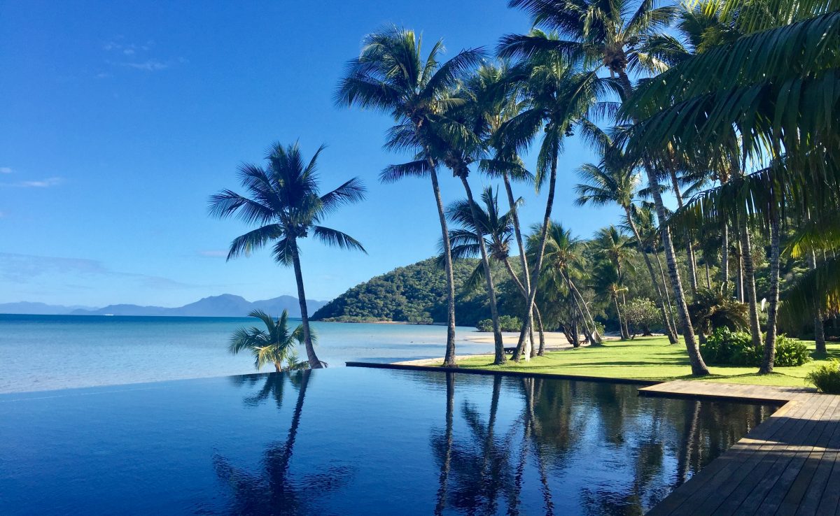
Green lake in park
ROMA
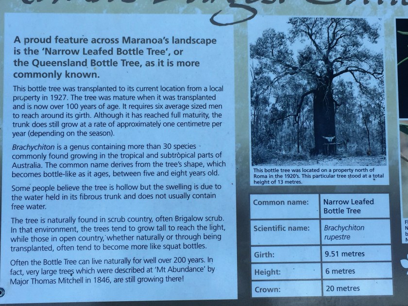
Sunday we left Injune at 8 and drove 90km to Roma. This was quite a large town and we stopped for morning tea at a pub that had been totally modernised – popular and good. We tried to book accommodation for Lightning Ridge and found it wasn’t so easy getting 2 nights. After noone around in Injune we were surprised at how busy Lightning Ridge appeared to be. Anyway we found a motel. Roma looked a prosperous town, due to the oil and gas mining. They had some lovely old boab trees, including their biggest with a girth of 9.51m and 6m tall. There was an Avenue of Heroes – 140 boab trees lining one main and 2 short streets, each commemorating fallen soldiers from the Roma district in WW1. The main street also had well restored pubs and wide streets.

ST GEORGE
From Roma it was nearly 2 hours to St George. We were surprised how small this town was. Cotton growing is one of its main industries, using channel irrigation to supply the water from the Balonne River. The land is so flat and the cultivated areas immense. It was named St George by the explorer Sir Major Thomas Mitchell who crossed the Balonne River on Saint George’s Day – 23/4/1846.
DIRRANBANDI
We bought lunch at one of the few places open, and the salad rolls were made very much on country time from a very ordinary looking place, but they tasted fine when we ate them, 89 kms later at Dirranbandi (meaning frog’s croaking). Another small quiet town with not much but a small well kept park. This town is very close to Cubby Station, the largest cotton farm in the Southern Hemisphere.
HEBEL
Next town, was Hebel, just before the NSW border. This really did only have a pub and General Store. The pub was so outback – corrugated iron, wooden walls, everything rusty, broken or dangling. Utes were parked out front and it was very busy with the locals (all middle aged and male, with their big hats and boots and no women) drinking and talking. To the side was the “bistro” another rough corrugated iron structure with 2 windows, presumably to be served through. It is said that the pub opened in 1894 as a Cobb and Co changing station and was originally called the Commercial Hotel.
When crossing the border, there were so many signs for those entering Qld of what they could not take into the state. There were no signs coming into NSW???

It was only 63km and then we turned off to Lightning Ridge.
ROAD TO LIGHTNING RIDGE
We travelled 7 hours yesterday and 6 today and the whole way, since Biloela, the roads have had signs that they flood and indicators showing the depth. The roads have been flat, except for a couple of times when we rose to 400+m – once between Banana and Rolleston and today on the Great Dividing Range. Each was just an incline and not really noticeable. What it does show is how flat Qld is and how when there is a lot of rain in the north, floodwater spreads over such vast distances.
There has been a lot of road kill. Mostly kangaroos, but today a goat. We stopped or slowed for kangaroos twice today. We also stopped and then drove slowly because cows were grazing beside the road and were wandering from side to side of the road. They were being moved by men on quad bikes and their trusty dogs. It seemed they were feeding on the grass beside the road as the land on the other side of the fences had no feed. It was quite dry and dusty.